Login

Forgotten password?

Cookies have to be accepted!
Your browser's cookie functionality is disabled. Please enable this functionality.

Not a member yet?

Register now
Login

Available for registred users only

Log in to use this feature.

Forgotten password?

Cookies have to be accepted!
Your browser's cookie functionality is disabled. Please enable this functionality.

Not a member yet?

Register now
Filter
Categories
Advanced filters
  • Distance (km)
  • Height
Save filters Reset filter

TrackRank

QRCode

Technical data

Distance26,4 km Height1222 m Way down1227 m Duration00:00 h:m Date14.10.2010
Scores Author Landscape Fun factor Fitness Technique

Statistics

1197 Views Scores 135 Downloads Average
Rate
  • Track data sheet
  • Directions
  • Downloads

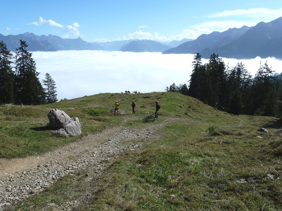
Herbsttour auf 1700 Meter für Nebelflüchtige. Weitestgehend auf Fahrwegen. Am Sattel Abstecher auf die Mondspitze möglich (dann noch 200 Höhenmeter). Abfahrt über ein paar kurze Trails mit Aussicht (Alternative: Fahrweg), sonst Fahrwege.

Tour map and elevation profile

  • Open Street Map
  • Google
Minimum height 523 m Maximum height 1714 m Detailed view

More about the tour author

Nasenfahrrad
Member since 2010

Send private message

Comments

GPS tracks

Trackpoints
  • GPX / Garmin Map Source (gpx) download
  • TCX / Garmin Training Center® (tcx) download
  • CRS / Garmin Training Center® (crs) download
  • Google Earth (kml) download
  • G7ToWin (g7t) download
  • TTQV (trk) download
  • Overlay (ovl) download
  • Fugawi (txt) download
  • Kompass (DAV) Track (tk) download
  • Track data sheet (pdf) download
  • Original file of the author (gpx) download

More about the tour author

Nasenfahrrad
Member since 2010

Send private message
Share track
Add to my favorites
Remove from my favorites
Edit tags
My score
Rate
Track: Nenzing-Mondspitze-Furkaalpe-Ronaalpe-Nenzing
Type: Mountain bike
Distance: 26,4 km
Evaluated on:
Duration:
Day(s)
Hour(s)
Minute(s)
Score: Landscape Fun factor Fitness Technique