Login

Forgotten password?

Cookies have to be accepted!
Your browser's cookie functionality is disabled. Please enable this functionality.

Not a member yet?

Register now
Login

Available for registred users only

Log in to use this feature.

Forgotten password?

Cookies have to be accepted!
Your browser's cookie functionality is disabled. Please enable this functionality.

Not a member yet?

Register now
Filter
Categories
Advanced filters
  • Distance (km)
  • Height
Save filters Reset filter

TrackRank

QRCode

Technical data

Distance48,8 km Height819 m Way down828 m Duration00:00 h:m Date25.01.2011
Scores Author Landscape Fun factor Fitness Technique

Statistics

679 Views Scores 168 Downloads Average
Rate
  • Track data sheet
  • Directions
  • Downloads

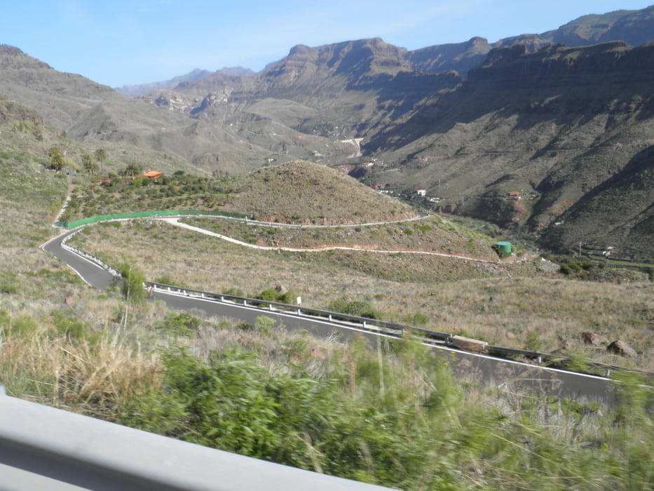
Von Player del Inglés führt die Runde durch das Schilftal zum Ayagaures-Stausee, wo der der kurze, knackige Anstieg zum Pedro-Gonzáles-Pass wartet. Oben entschädigt der Blick in den Palmitos Park.

Tour gallery

Tour map and elevation profile

  • Open Street Map
  • Google
Minimum height 12 m Maximum height 501 m Detailed view

More about the tour author

rockefeller13
Member since 2010

Send private message

Comments

GPS tracks

Trackpoints
  • GPX / Garmin Map Source (gpx) download
  • TCX / Garmin Training Center® (tcx) download
  • CRS / Garmin Training Center® (crs) download
  • Google Earth (kml) download
  • G7ToWin (g7t) download
  • TTQV (trk) download
  • Overlay (ovl) download
  • Fugawi (txt) download
  • Kompass (DAV) Track (tk) download
  • Track data sheet (pdf) download
  • Original file of the author (gpx) download

More about the tour author

rockefeller13
Member since 2010

Send private message
Share track
Add to my favorites
Remove from my favorites
Edit tags
My score
Rate
Track: Monte León
Type: Road biking
Distance: 48,8 km
Evaluated on:
Duration:
Day(s)
Hour(s)
Minute(s)
Score: Landscape Fun factor Fitness Technique