


Sehr guter Traingsrun Immer steiler werdend. Zum Schluss (letzte 200hm) lassen die steilen Stücke auch nicht aus und sind dazu noch in praller Sonne. Dauer: 1:45h
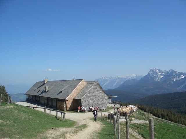
Die Stoisser Alm ist ein XXL Radltreff. Da es die letzten 200m geradeaus auf die Terrasse der Alm drauf zu geht kann man hier gut Posen. Und andere gut lästern. Mir ist es so vor gekommen, als ob man wegen der Masse der Radler hier schon auf das Grüßen verzichtet.
Schade.
Gute Aussicht nur direkt an der Stoisser Alm.
Further information at
http://www.martin-blum.de/bikeTour gallery
Tour map and elevation profile
Minimum height 820 m
Maximum height 1273 m
More about the tour author
|
|
martin.blum |
Comments
Autobahn A8 München-Salzburg. Nehmt die Ausfahrt Siegsdorf, von da immer Richtung Inzell. In Inzell (Mitte) links nach Adlgaß.
Dort den Wanderparkplatz nehmen.
GPS tracks
Trackpoints-
GPX / Garmin Map Source (gpx) download
-
TCX / Garmin Training Center® (tcx) download
-
CRS / Garmin Training Center® (crs) download
-
Google Earth (kml) download
-
G7ToWin (g7t) download
-
TTQV (trk) download
-
Overlay (ovl) download
-
Fugawi (txt) download
-
Kompass (DAV) Track (tk) download
-
Track data sheet (pdf) download
-
Original file of the author (gpx) download
More about the tour author
|
|
martin.blum |
Add to my favorites
Remove from my favorites
Edit tags
Open track
My score
Rate
Nur für die Harten ...