


Das Wetter warschön und eigentlich hatten wir eine größere Runde geplant.
Aber wie das so ist kommt es anders als man denkt. Die BVG Fähre startet erst wieder an Ostern. Im Winter ist Pause.
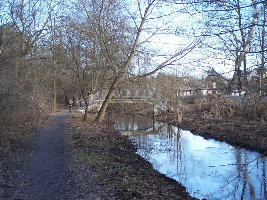
So machten wir eben eine kleine Runde durch den Wald von Wilhelmshagen. Der Abstecher durch das Strandbad am Müggelsee ist auch im Winter nett. Allein es fehlen die Möglichkeiten zum "girlwachten".
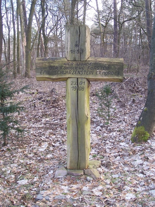
Bemerkenswert ist das Holzkreuz das an den nicht aufgeklärten Mord an einem Förster erinnert.
Der link führt zu dem entsprechenden geocache.
Further information at
http://www.brandenburg-reise.com/kurztrips/im-winter-ins-strandbad-mueggelsee/Tour gallery
Tour map and elevation profile
Minimum height 24 m
Maximum height 40 m
More about the tour author
|
|
Pheinz |
Comments

S-Bahnhof Rahnsdorf.
Falls die Bahn fährt.
GPS tracks
Trackpoints-
GPX / Garmin Map Source (gpx) download
-
TCX / Garmin Training Center® (tcx) download
-
CRS / Garmin Training Center® (crs) download
-
Google Earth (kml) download
-
G7ToWin (g7t) download
-
TTQV (trk) download
-
Overlay (ovl) download
-
Fugawi (txt) download
-
Kompass (DAV) Track (tk) download
-
Track data sheet (pdf) download
-
Original file of the author (gpx) download
More about the tour author
|
|
Pheinz |
Add to my favorites
Remove from my favorites
Edit tags
Open track
My score
Rate