


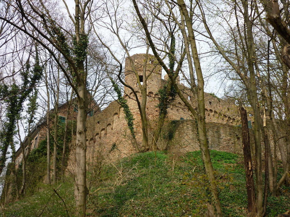
Wir starten in Zwingenberg und wandern über das Auerbacher Schloss auf den Melibokus (517m). Auf dem Rückweg nach Zwingenberg kommt man noch am Alsbacher Schloss vorbei. Die Tour geht in der ersten Hälfte permanent bergauf, ist aber nicht übermäßig steil. Anfangs läuft man durch Weinberge, später überwiegend durch Wald. Die Wege sind meist breit und gut begehbar. Man hat schöne Blicke über die Rheinebene.
Tour gallery

Tour map and elevation profile
Minimum height 72 m
Maximum height 526 m
More about the tour author

|
JuliaHolg |
Comments

Man erreicht Zwingenberg über die entsprechende Ausfahrt der Autobahn A5. Kostenlos parken kann man beispielsweise auf dem Parkplatz der Melibokushalle in der Ortsmitte.
GPS tracks
Trackpoints-
GPX / Garmin Map Source (gpx) download
-
TCX / Garmin Training Center® (tcx) download
-
CRS / Garmin Training Center® (crs) download
-
Google Earth (kml) download
-
G7ToWin (g7t) download
-
TTQV (trk) download
-
Overlay (ovl) download
-
Fugawi (txt) download
-
Kompass (DAV) Track (tk) download
-
Track data sheet (pdf) download
-
Original file of the author (gpx) download
More about the tour author
|
|
JuliaHolg |
Add to my favorites
Remove from my favorites
Edit tags
Open track
My score
Rate