


Dal parcheggio di via Cairoli a Laives ci incamminiamo in salita lungo la via Pietralba fino ad incrociare,a sinistra,il sentiero N°11 che seguiamo,in salita abbastanza ripida,
fino al maso Untersteiner dove,poco sopra,incrociamo il sentiero N° 12 che seguiamo,fino ad arrivare al maso Hochegger in circa 2 ore.
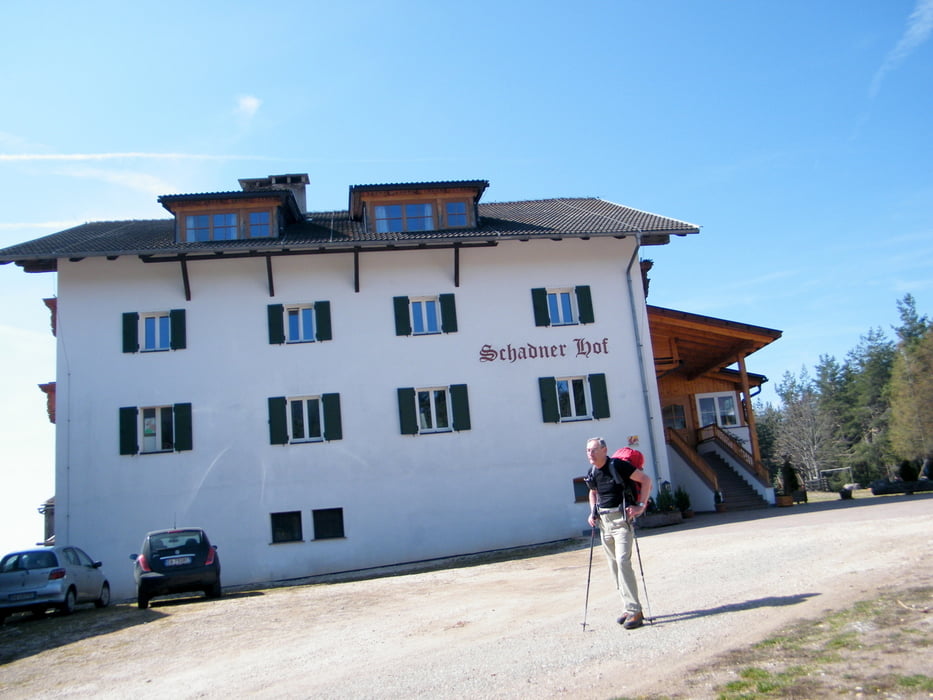
Ci accorgiamo che è troppo presto e decidiamo così una divagazione che,con il sentiero N° 10 in circa 500 m. di dislivello ci porta,dopo circa 1ora e 30,nella spianata di maso Shadner dove ci fermiamo per il pranzo al sacco(Chi non volesse effettuare questa appendice può proseguire per il sentiero 12 che in 1 ora arriva al maso Scwab)
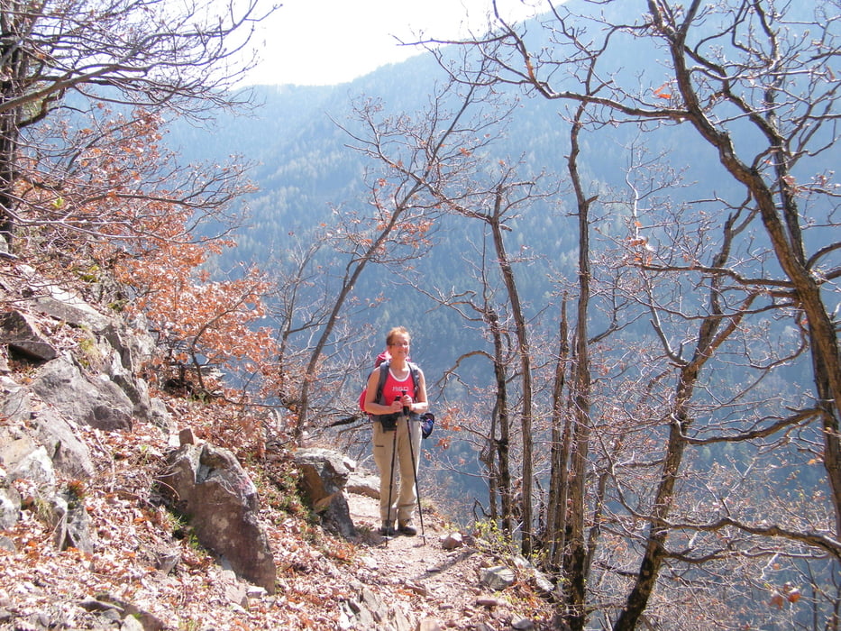
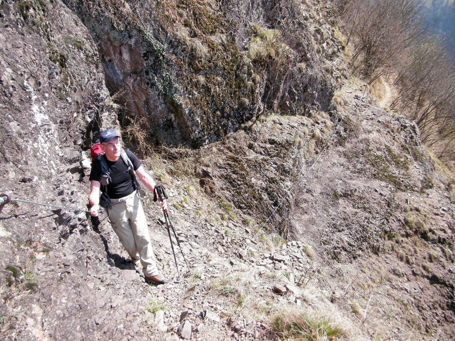
Ritorniamo sui nostri passi fino ad incontrare nuovamente l'incrocio con il 12 che seguiamo costeggiando ad una altezza di circa 400 m., con qualche breve e facile tratto attrezzato (cordini),la forra del torrente Brantenbach calando poi nella valle fino al maso Schwab dove possiamo fermarci a calmare la sete.
Con un ultimo strappo in discesa ci portiamo sulla strada asfaltata che,percorrendo la selvaggia Brantental,ci riporta al parcheggio.
fino al maso Untersteiner dove,poco sopra,incrociamo il sentiero N° 12 che seguiamo,fino ad arrivare al maso Hochegger in circa 2 ore.
Ci accorgiamo che è troppo presto e decidiamo così una divagazione che,con il sentiero N° 10 in circa 500 m. di dislivello ci porta,dopo circa 1ora e 30,nella spianata di maso Shadner dove ci fermiamo per il pranzo al sacco(Chi non volesse effettuare questa appendice può proseguire per il sentiero 12 che in 1 ora arriva al maso Scwab)
Ritorniamo sui nostri passi fino ad incontrare nuovamente l'incrocio con il 12 che seguiamo costeggiando ad una altezza di circa 400 m., con qualche breve e facile tratto attrezzato (cordini),la forra del torrente Brantenbach calando poi nella valle fino al maso Schwab dove possiamo fermarci a calmare la sete.
Con un ultimo strappo in discesa ci portiamo sulla strada asfaltata che,percorrendo la selvaggia Brantental,ci riporta al parcheggio.
Tour gallery
Tour map and elevation profile
Minimum height 273 m
Maximum height 1378 m
More about the tour author

|
lele47 |
Comments

GPS tracks
Trackpoints-
GPX / Garmin Map Source (gpx) download
-
TCX / Garmin Training Center® (tcx) download
-
CRS / Garmin Training Center® (crs) download
-
Google Earth (kml) download
-
G7ToWin (g7t) download
-
TTQV (trk) download
-
Overlay (ovl) download
-
Fugawi (txt) download
-
Kompass (DAV) Track (tk) download
-
Track data sheet (pdf) download
-
Original file of the author (gpx) download
More about the tour author
|
|
lele47 |
Add to my favorites
Remove from my favorites
Edit tags
Open track
My score
Rate