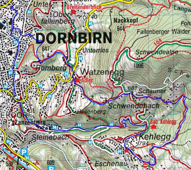
Feierabendtour über Dornbirn Kehlegg, Schwefel, Schauner, steile Abfahrt tw. auf Schotter, tolle Aussicht auf Rheintal, First, Säntis, Hoher Kasten und Bodensee
ca. 500 Höhenmeter
ca. 500 Höhenmeter
Further information at
http://klauserg.dyndns.org/1701_index_sport_bike.php#ziel3Tour gallery
Tour map and elevation profile
Minimum height 433 m
Maximum height 975 m
Comments

Feierabendrunde Dornbirn Schauner
GPS tracks
Trackpoints-
GPX / Garmin Map Source (gpx) download
-
TCX / Garmin Training Center® (tcx) download
-
CRS / Garmin Training Center® (crs) download
-
Google Earth (kml) download
-
G7ToWin (g7t) download
-
TTQV (trk) download
-
Overlay (ovl) download
-
Fugawi (txt) download
-
Kompass (DAV) Track (tk) download
-
Track data sheet (pdf) download
-
Original file of the author (gpx) download
Add to my favorites
Remove from my favorites
Edit tags
Open track
My score
Rate


