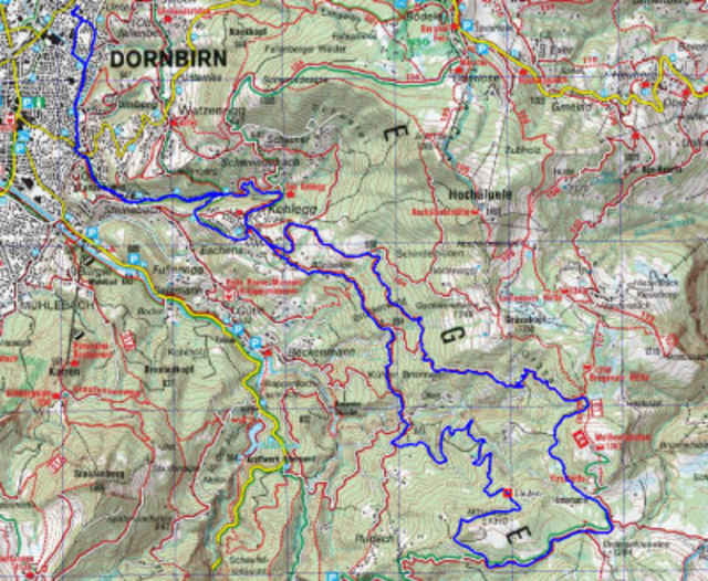
Schöne Fahrt über Kehlegg, Forsthaus, Alpe Saeck, Alpe Müsel dann über Hotter nach Kehlegg. Alternativ kann auch zur Alpe Kobel oder zur Weisfluhalpe oder zur Brgenzer Hütte noch ein Abstecher eingebaut werden. Total ca. 965 Höhenmeter.
Nach Alpe Säck (bei WP 014) ist eine kurzes Tragestück etwa 300 m recht steil und bei Nässe rutschig durch den Wald bergan.
Nach Alpe Säck (bei WP 014) ist eine kurzes Tragestück etwa 300 m recht steil und bei Nässe rutschig durch den Wald bergan.
Further information at
http://klauserg.dyndns.org/1701_index_sport_bike.php#ziel5Tour map and elevation profile
Minimum height 440 m
Maximum height 1289 m
Comments

Dornbirner Alpenrunde
GPS tracks
Trackpoints-
GPX / Garmin Map Source (gpx) download
-
TCX / Garmin Training Center® (tcx) download
-
CRS / Garmin Training Center® (crs) download
-
Google Earth (kml) download
-
G7ToWin (g7t) download
-
TTQV (trk) download
-
Overlay (ovl) download
-
Fugawi (txt) download
-
Kompass (DAV) Track (tk) download
-
Track data sheet (pdf) download
-
Original file of the author (gpx) download
Add to my favorites
Remove from my favorites
Edit tags
Open track
My score
Rate


