Login

Forgotten password?

Cookies have to be accepted!
Your browser's cookie functionality is disabled. Please enable this functionality.

Not a member yet?

Register now
Login

Available for registred users only

Log in to use this feature.

Forgotten password?

Cookies have to be accepted!
Your browser's cookie functionality is disabled. Please enable this functionality.

Not a member yet?

Register now
Filter
Categories
Advanced filters
  • Distance (km)
  • Height
Save filters Reset filter

TrackRank

QRCode

Technical data

Distance24,3 km Height1292 m Way down1291 m Duration04:00 h:m Date04.06.2011
Scores Author User Landscape Fun factor Fitness Technique

Statistics

2973 Views 1 Score 165 Downloads 5.00 Average
Rate
  • Track data sheet
  • Directions
  • Downloads

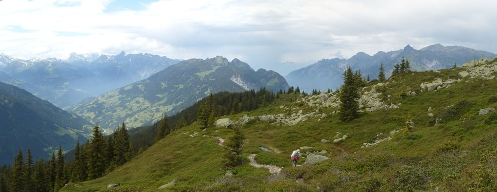
Endurotour für MTB Experten mit ca. 45min Laufanteil,
je nach Fahrkönnen auch bergab Laufpassagen.

Eine der schwereren Touren die ich immer wieder gerne fahre, am Anfang S2/S3 dann bis zum Kristbergsattel S1/S2, dann teilweise schwere, steile und ausgesetzte Abfahrt mit schweren Kehren S1-S3 nach Dalaas Poller. Scheint eine lokale donnhill Strecke zu sein. Ich frage mich wie die um die Kurve kommen, versetzen reicht da nicht.... Respekt dem/der alles fähren kann.


Tour gallery

Tour map and elevation profile

  • Open Street Map
  • Google
Minimum height 833 m Maximum height 2063 m Detailed view

More about the tour author

skyhopper
Member since 2005

Send private message

Comments

Kanski on 13.08.2017

Enduro tour

We did this tour but used the lift up from Dalaas. We started in Schruns and biked our way up into Silbertal. Took the lift up and the track down to Dalaas, which is really more S2/S3! Must say it was still wet from the days before. From Sonnenkopf it's a nice bike up till where you have to lift the bike onto the shoulders, and then al the way up to the cross. From there an awesome trail starts. The beginning is pretty though S2/S3. Further down it becomes a bit easier. For Enduro lovers! But you gotta be good on the bike.

Auf Autobahn von Bregenz bis Abfahrt Dallas. Parken in Dalaas am Ortseingang.


GPS tracks

Trackpoints
  • GPX / Garmin Map Source (gpx) download
  • TCX / Garmin Training Center® (tcx) download
  • CRS / Garmin Training Center® (crs) download
  • Google Earth (kml) download
  • G7ToWin (g7t) download
  • TTQV (trk) download
  • Overlay (ovl) download
  • Fugawi (txt) download
  • Kompass (DAV) Track (tk) download
  • Track data sheet (pdf) download
  • Original file of the author (gpx) download

More about the tour author

skyhopper
Member since 2005

Send private message
Share track
Add to my favorites
Remove from my favorites
Edit tags
My score
Rate
Track: Dalaas Sonnenkopf Muttjöchle Kristbergsattel Enduro
Type: Mountain bike
Distance: 24,3 km
Evaluated on:
Duration:
Day(s)
Hour(s)
Minute(s)
Score: Landscape Fun factor Fitness Technique