


Am Restaurant Wißkirchen vorbei; hinter Friedhof schräg rechts hoch an zum Naturdenkmal Rösberg; zurück zur Gabelung dann rechts; am Fußballplatz vorbei weiter bis zur L101; diese überqueren und nach ca. 100m nach links; durch Baumallee bis zum Eingang Wildgehege; Weg weiter folgen und nach Bachüberquerung nach links zurück bis zum Ausgang des Wildgeheges; erneut L101 überqueren und zum Altenberger Dom;
Sehenswürdigkeiten:
- Naturdenkmal Rösberg
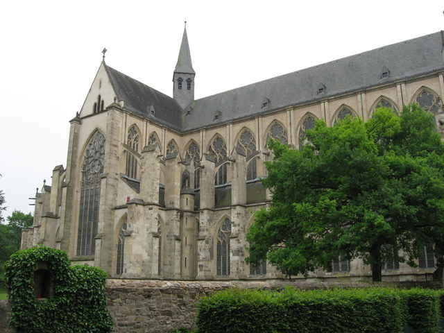
- Altenberger Dom
schöner Nachmittagsspaziergang auch für Familien mit Kindern geeignet.
Sehenswürdigkeiten:
- Naturdenkmal Rösberg
- Altenberger Dom
schöner Nachmittagsspaziergang auch für Familien mit Kindern geeignet.
Tour gallery
Tour map and elevation profile
Minimum height 78 m
Maximum height 148 m
More about the tour author

|
Comments

Parkplatz vor Restaurant Wißkirchen oder am Altenberger Dom
GPS tracks
Trackpoints-
GPX / Garmin Map Source (gpx) download
-
TCX / Garmin Training Center® (tcx) download
-
CRS / Garmin Training Center® (crs) download
-
Google Earth (kml) download
-
G7ToWin (g7t) download
-
TTQV (trk) download
-
Overlay (ovl) download
-
Fugawi (txt) download
-
Kompass (DAV) Track (tk) download
-
Track data sheet (pdf) download
-
Original file of the author (g7t) download
More about the tour author
|
|
Add to my favorites
Remove from my favorites
Edit tags
Open track
My score
Rate