Login

Forgotten password?

Cookies have to be accepted!
Your browser's cookie functionality is disabled. Please enable this functionality.

Not a member yet?

Register now
Login

Available for registred users only

Log in to use this feature.

Forgotten password?

Cookies have to be accepted!
Your browser's cookie functionality is disabled. Please enable this functionality.

Not a member yet?

Register now
Filter
Categories
Advanced filters
  • Distance (km)
  • Height
Save filters Reset filter

TrackRank

QRCode

Technical data

Distance137,8 km Height4010 m Way down3908 m Duration07:33 h:m Date06.08.2011
Scores Author User Landscape Fun factor Fitness Technique

Statistics

640 Views 2 Scores 178 Downloads 5.00 Average
Rate
  • Track data sheet
  • Directions
  • Downloads
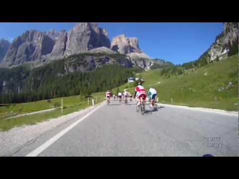
Eines der besten Radrennen ist der Dolomiten -Marathon .Die Strecke führt über folgende Pässe Campolongo 1875 m,Pordoi 2239m ,Sella 2244m. GrödnerJoch 2121 m,Campolongo 1875 m, Giau 2236 m ,Falarego 2117 m , Valparola 2200 m

Tour gallery

Tour map and elevation profile

  • Open Street Map
  • Google
Minimum height 1331 m Maximum height 2241 m Detailed view

More about the tour author

Red-Marin
Member since 2009

Send private message

Comments

GPS tracks

Trackpoints
  • GPX / Garmin Map Source (gpx) download
  • TCX / Garmin Training Center® (tcx) download
  • CRS / Garmin Training Center® (crs) download
  • Google Earth (kml) download
  • G7ToWin (g7t) download
  • TTQV (trk) download
  • Overlay (ovl) download
  • Fugawi (txt) download
  • Kompass (DAV) Track (tk) download
  • Track data sheet (pdf) download
  • Original file of the author (tcx) download

More about the tour author

Red-Marin
Member since 2009

Send private message
Share track
Add to my favorites
Remove from my favorites
Edit tags
My score
Rate
Track: Maratona dles Dolomites
Type: Road biking
Distance: 137,8 km
Evaluated on:
Duration:
Day(s)
Hour(s)
Minute(s)
Score: Landscape Fun factor Fitness Technique