Login

Forgotten password?

Cookies have to be accepted!
Your browser's cookie functionality is disabled. Please enable this functionality.

Not a member yet?

Register now
Login

Available for registred users only

Log in to use this feature.

Forgotten password?

Cookies have to be accepted!
Your browser's cookie functionality is disabled. Please enable this functionality.

Not a member yet?

Register now
Filter
Categories
Advanced filters
  • Distance (km)
  • Height
Save filters Reset filter

TrackRank

QRCode

Technical data

Distance121,5 km Height1254 m Way down1293 m Duration06:31 h:m Date24.09.2011
Scores Author Landscape Fun factor Fitness Technique

Statistics

747 Views Scores 16 Downloads Average
Rate
  • Track data sheet
  • Directions
  • Downloads

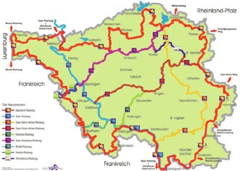
Gestartet haben wir die Rundfahrt in Werschweiler (bei St. Wendel).

Von dort geht es nach Freisen, dann zum Bostalsee, zur Nonnweiler Talsperre, an den Losheimer Stausee und dann nach Mettlach.

Ist ne schöne Strecke.

Erster Tag geht bis Taben-Rodt.

Tour map and elevation profile

  • Open Street Map
  • Google
Minimum height 161 m Maximum height 582 m Detailed view

More about the tour author

bike82
Member since 2011

Send private message

Comments

GPS tracks

Trackpoints
  • GPX / Garmin Map Source (gpx) download
  • TCX / Garmin Training Center® (tcx) download
  • CRS / Garmin Training Center® (crs) download
  • Google Earth (kml) download
  • G7ToWin (g7t) download
  • TTQV (trk) download
  • Overlay (ovl) download
  • Fugawi (txt) download
  • Kompass (DAV) Track (tk) download
  • Track data sheet (pdf) download
  • Original file of the author (gpx) download

More about the tour author

bike82
Member since 2011

Send private message
Share track
Add to my favorites
Remove from my favorites
Edit tags
My score
Rate
Track: Saarland Rundfahrt Tag 1
Type: Mountain bike
Distance: 121,5 km
Evaluated on:
Duration:
Day(s)
Hour(s)
Minute(s)
Score: Landscape Fun factor Fitness Technique