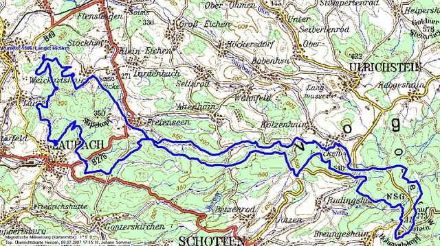
CTF des RSC Grünberg zum Hoherodskopf, gefahren am 8.7.2007.
Eine schöne CTF mit herrlichen Ausblicken.
"Dank" Kyrill waren die schönen Trails am Hoherodskopf durch umgestürzte Bäume blockiert. Daher mußte der Veranstalter über Strasse und Teerwege umleiten. Das heisst diesmal recht wenig Singltrail, dafür aber flott zu fahren.
Eine schöne CTF mit herrlichen Ausblicken.
"Dank" Kyrill waren die schönen Trails am Hoherodskopf durch umgestürzte Bäume blockiert. Daher mußte der Veranstalter über Strasse und Teerwege umleiten. Das heisst diesmal recht wenig Singltrail, dafür aber flott zu fahren.
Tour gallery
Tour map and elevation profile
Minimum height 224 m
Maximum height 752 m
Comments
Start und Ziel Theo-Koch-Schule, Struppiusstr., 35305 Grünberg
GPS tracks
Trackpoints-
GPX / Garmin Map Source (gpx) download
-
TCX / Garmin Training Center® (tcx) download
-
CRS / Garmin Training Center® (crs) download
-
Google Earth (kml) download
-
G7ToWin (g7t) download
-
TTQV (trk) download
-
Overlay (ovl) download
-
Fugawi (txt) download
-
Kompass (DAV) Track (tk) download
-
Track data sheet (pdf) download
-
Original file of the author (gpx) download
Add to my favorites
Remove from my favorites
Edit tags
Open track
My score
Rate


CTF RSC Grünberg
Toll
Wer mehr will, sollte Samstags (14:30Uhr) zu Volkers Bikeladen nach Borsdorf(Nidda, In den neuen Morgen) kommen. Es wird sehr Traillastig gefahren!