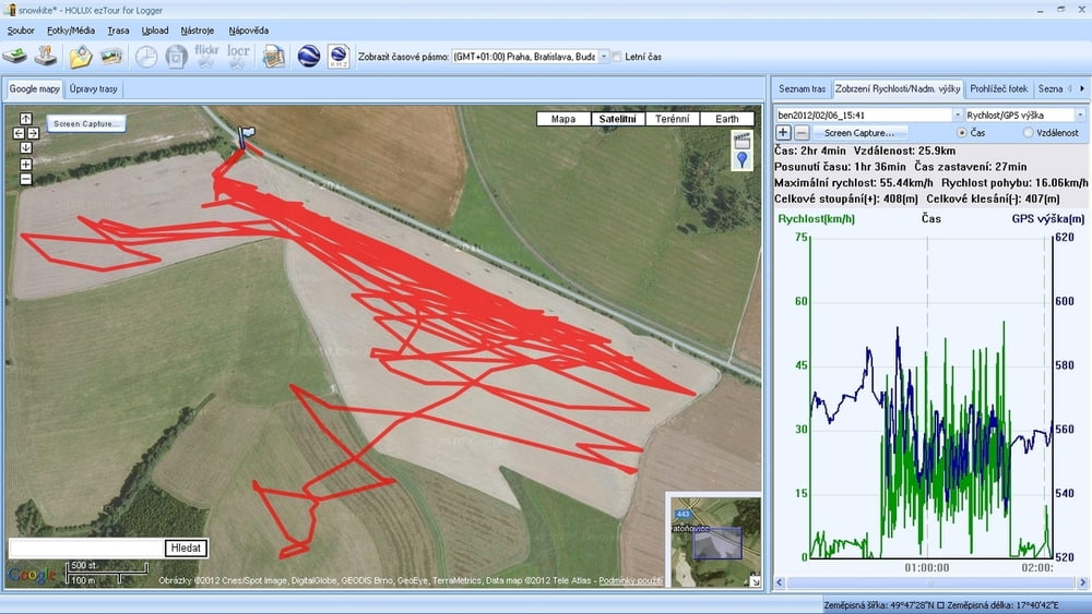
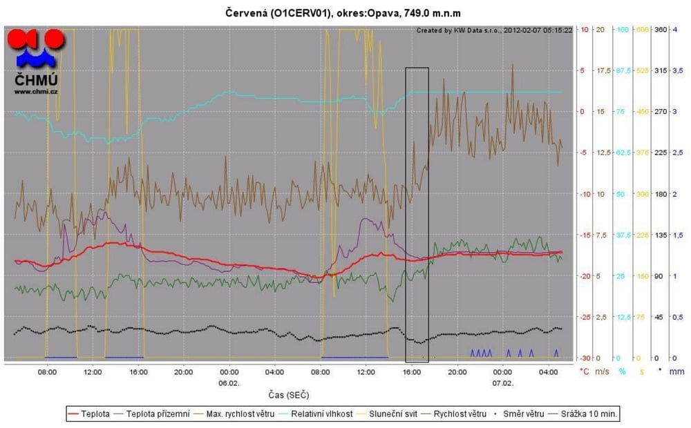
6.2.2012, 15:30 - 17:30, W: SSV 11-14ms T: -14 až -16°C, kite: Ozone Access 4, top speed 56km/h
závody s auty, atobusy a vlaky - některá osobní auta stačila, zbytek neměl šanci, sbalil sem to , až když už nebyly vidět OT plynovodu
Tour gallery
Tour map and elevation profile
Minimum height 535 m
Maximum height 593 m
Comments

GPS tracks
Trackpoints-
GPX / Garmin Map Source (gpx) download
-
TCX / Garmin Training Center® (tcx) download
-
CRS / Garmin Training Center® (crs) download
-
Google Earth (kml) download
-
G7ToWin (g7t) download
-
TTQV (trk) download
-
Overlay (ovl) download
-
Fugawi (txt) download
-
Kompass (DAV) Track (tk) download
-
Track data sheet (pdf) download
-
Original file of the author (gpx) download
Add to my favorites
Remove from my favorites
Edit tags
Open track
My score
Rate


