


Gestartet wird in Fridingen am Parkplatz „Skihütte-Naturbühne Steintäle“.
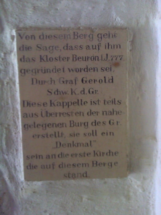
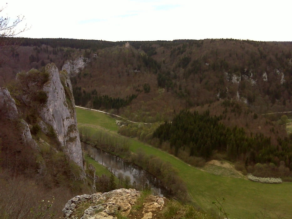
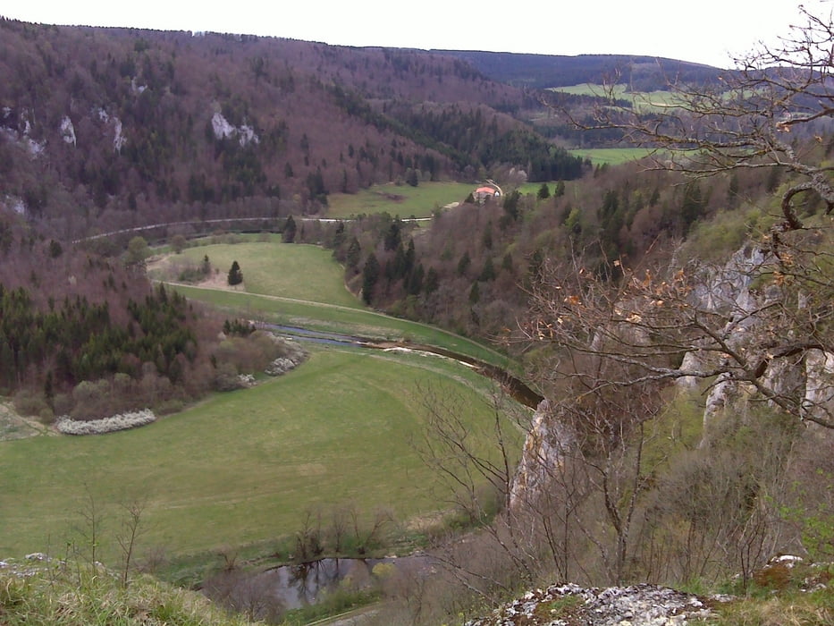
Auf dem Wanderweg gehts rechts vom Skihang den Berg hoch zum ersten Aussichtspunkt Burgsteig, danch über Burgstall erreicht man die Mattheisen Kapelle, die auf die Gründung des Klosters Beuron hinweist. Der Blick vom Stiegelesfelsen ist einmalig. Von dort geht es weiter zum Knopfmacherfelsen und dann wieder runter nach Fridingen zurück zum Ausgangspunkt.
Beim Knopfmacherfelsen gibt es auch ein gutes Ausflugslokal.
Die Tour ist für Familien geeignet, nicht kinderwagentauglich da die Aufstiege zum Teil schmal und steil sind.
Further information at
http://www.donaubergland.de/mcms.php?_oid=f26fa4e-7387-e3e3-f57b-7bfee76b97e43&_template=viewTour gallery
Tour map and elevation profile
Minimum height 633 m
Maximum height 794 m
More about the tour author
|
|
wsauter |
Comments

Folgen Sie in Fridingen der Beschilderung Skihütte oder Naturbühne Steintäle. Sie erreichen den Wanderparkplatz ohne Probleme.
GPS tracks
Trackpoints-
GPX / Garmin Map Source (gpx) download
-
TCX / Garmin Training Center® (tcx) download
-
CRS / Garmin Training Center® (crs) download
-
Google Earth (kml) download
-
G7ToWin (g7t) download
-
TTQV (trk) download
-
Overlay (ovl) download
-
Fugawi (txt) download
-
Kompass (DAV) Track (tk) download
-
Track data sheet (pdf) download
-
Original file of the author (gpx) download
More about the tour author
|
|
wsauter |
Add to my favorites
Remove from my favorites
Edit tags
Open track
My score
Rate