


Subway from the Bottom, Left Fork of North Creek
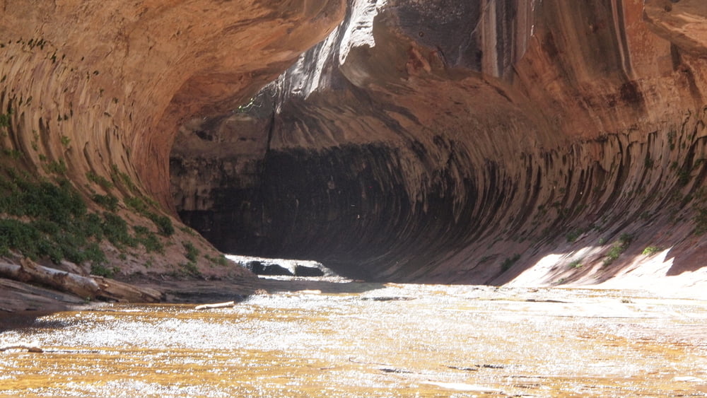
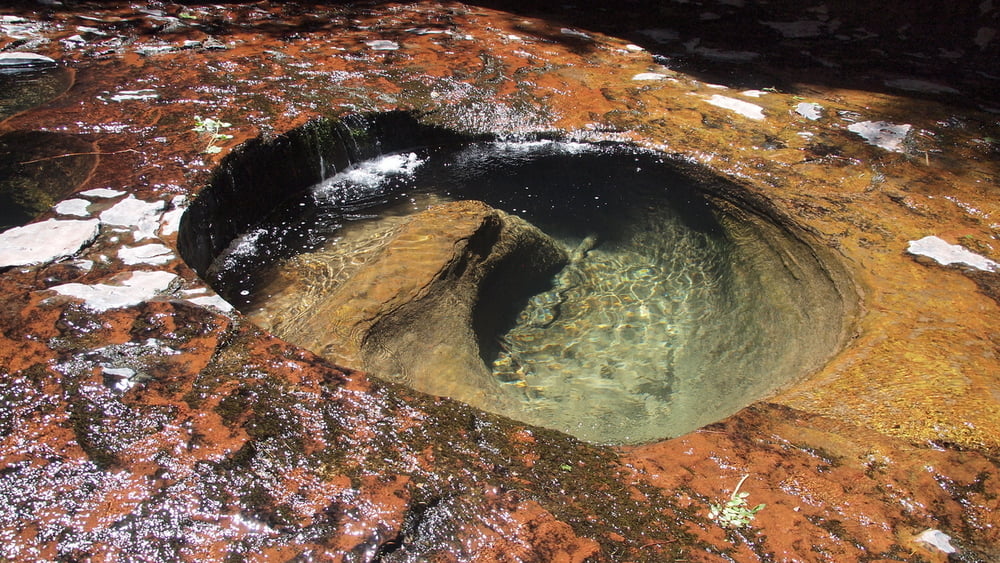
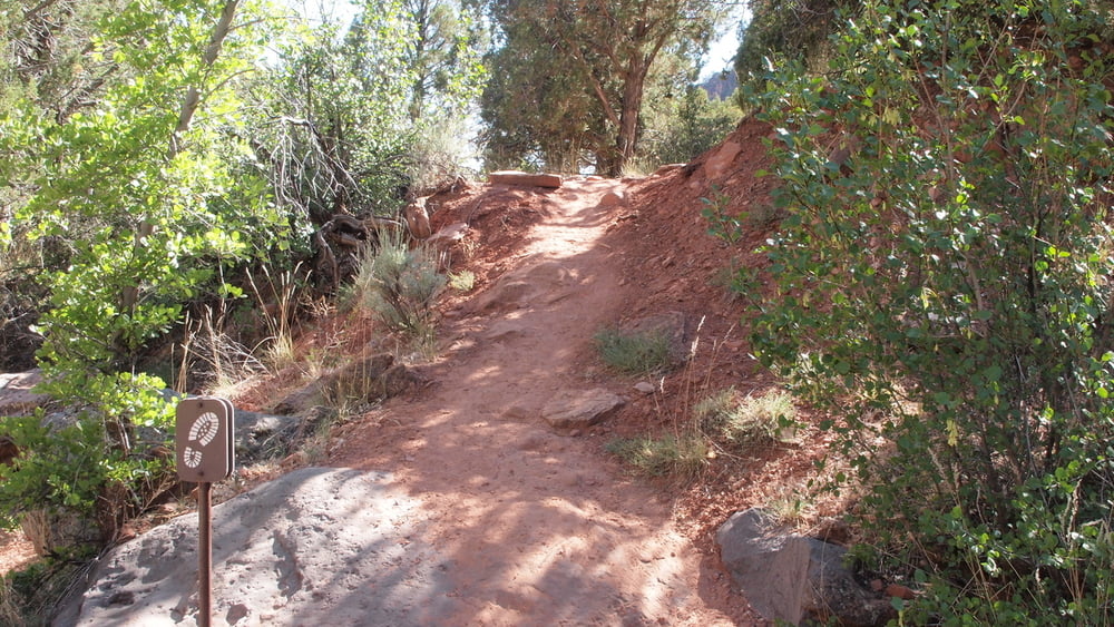
The Left Fork of North Creek is one of the most beautiful and most popular canyons in the backcountry of Zion. The most famous section of this canyon is known as "The Subway" an amazing half-mile stretch that resembles a tubular tunnel. The Subway is a strenuous and demanding backcountry hike.This is a strenuous 9 mile round trip hike requiring route finding, stream crossings, and scrambling over boulders. The route is often slippery. This hike begins and ends at the Left Fork Trailhead off of the Kolob Terrace Road.Obtain a permit.(a lottery system is in place)
Get in shape.
Know before you go, as with any backcountry trail.
Pack appropriately, although the Subway is only a day hike, your list should include: plenty of water, energy sustaining snacks, sunblock, a good hat.....
Check the weather forecast.
Leave no trace When hiking anywhere in nature.
Túra fotóalbuma


Túratérkép és magasságprofil
Minimum height 1418 m
Maximum height 1764 m
More about the tour author

|
willydn |
Megjegyzések

Directions
From Springdale, drive south and west 14 miles to the town of Virgin. Turn right (north) on the Kolob. Reservoir Road (KR road, sometimes called the Kolob Terrace (KT) road). The paved KR road winds through town, then climbs a dramatic ridge in making its way to Kolob Terrace. Six and a half miles from Virgin, the road enters the park and three trailheads are soon encountered – the Right Fork, Grapevine Springs, then the Left Fork. Park at the Left Fork Trailhead.
From Springdale, drive south and west 14 miles to the town of Virgin. Turn right (north) on the Kolob. Reservoir Road (KR road, sometimes called the Kolob Terrace (KT) road). The paved KR road winds through town, then climbs a dramatic ridge in making its way to Kolob Terrace. Six and a half miles from Virgin, the road enters the park and three trailheads are soon encountered – the Right Fork, Grapevine Springs, then the Left Fork. Park at the Left Fork Trailhead.
GPS trackek
Trackpoints-
GPX / Garmin Map Source (gpx) download
-
TCX / Garmin Training Center® (tcx) download
-
CRS / Garmin Training Center® (crs) download
-
Google Earth (kml) download
-
G7ToWin (g7t) download
-
TTQV (trk) download
-
Overlay (ovl) download
-
Fugawi (txt) download
-
Kompass (DAV) Track (tk) download
-
Túralap (pdf) download
-
Original file of the author (gpx) download
More about the tour author
|
|
willydn |
Add to my favorites
Remove from my favorites
Edit tags
Open track
My score
Rate