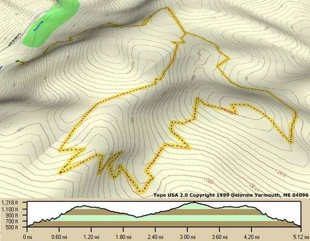
This area is soon to be developed, but the trail starts with a great 45 minute switchback uphill that is a nice challenge to start. Once you're at the top, you can wind around until you meet back up and head down at breakneck speeds.
Further information at
http://www.raidoh.comTúratérkép és magasságprofil
Minimum height 164 m
Maximum height 426 m
Megjegyzések

GPS trackek
Trackpoints-
GPX / Garmin Map Source (gpx) download
-
TCX / Garmin Training Center® (tcx) download
-
CRS / Garmin Training Center® (crs) download
-
Google Earth (kml) download
-
G7ToWin (g7t) download
-
TTQV (trk) download
-
Overlay (ovl) download
-
Fugawi (txt) download
-
Kompass (DAV) Track (tk) download
-
Túralap (pdf) download
-
Original file of the author (g7t) download
Add to my favorites
Remove from my favorites
Edit tags
Open track
My score
Rate


