

Dal paesino di Lazfóns, badando alla segnaletica, si sale al parcheggio del maso Kühhof (1550 m). Di qui la strada è chiusa al traffico. Si segue sempre il segnavia 1, che porta su comoda stradina fra boschi e prati alla baita Klausner (1919 m, ore 1.30). Continuando sulla larga via 1 / 17 fra pini mughi e lungo la Via Crucis in salita sul ripido versante, si giunge al santuario ed al rifugio Latzfonser Kreuz (Santa Croce di Lazfóns, 2311 m, aperto d’estate). Il rientro si snoda sulla stessa strada.
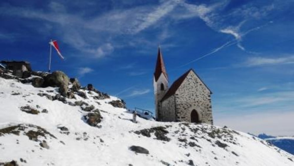
Santa Croce di Latzfons (2.298 m), il più alto luogo di pellegrinaggio d'Europa. Questa chiesetta, costruita nel 1868 sulle rovine di una piccola cappella, ospita in estate il "Jesù Cristo nero" (Schwarzen Herrgott), un'icona votiva che tutela l'escursionista dalle bizze del tempo. In primavera questa viene portata presso la chiesetta e riportata nuovamente a valle in autunno. Da qui, con poco meno di 300 m di dislivello, si può salire alla cima di San Cassiano che si trova sopra il luogo di pellegrinaggio.
Túra fotóalbuma


Túratérkép és magasságprofil
Minimum height 1662 m
Maximum height 2401 m
More about the tour author
|
|
bonani |
Megjegyzések

Lazfons si raggiunge uscendo dall'autostrada A22 alla stazione di Chiusa - Klausen. (si trova nel tratto tra Bressanone e Bolzano) Di qui si sale sulla montagna, in direzione ovest seguendo le indicazioni stradali per Latzfons
GPS trackek
Trackpoints-
GPX / Garmin Map Source (gpx) download
-
TCX / Garmin Training Center® (tcx) download
-
CRS / Garmin Training Center® (crs) download
-
Google Earth (kml) download
-
G7ToWin (g7t) download
-
TTQV (trk) download
-
Overlay (ovl) download
-
Fugawi (txt) download
-
Kompass (DAV) Track (tk) download
-
Túralap (pdf) download
-
Original file of the author (gpx) download
More about the tour author
|
|
bonani |
Add to my favorites
Remove from my favorites
Edit tags
Open track
My score
Rate