Login

Elfelejtetted a jelszód?

Cookies have to be accepted!
Your browser's cookie functionality is disabled. Please enable this functionality.

Not a member yet?

Register now
Login

Available for registred users only

Log in to use this feature.

Elfelejtetted a jelszód?

Cookies have to be accepted!
Your browser's cookie functionality is disabled. Please enable this functionality.

Not a member yet?

Register now
Filter
Kategóriák
Advanced filters
  • Hosszúság (km)
  • Szintkülönbség
Szűrő elmentése Reset filter

TrackRank

QRCode

Technical data

Hosszúság59,9 km Szintkülönbség2291 m Way down2283 m Tartam05:38 h:m Dátum16.07.2013
Értékelések Author Vidék Szórakozás Kondíció Technika

Statisztika

409 Views 1 Értékelés 84 Letöltések 5.00 átlag
Rate
  • Túralap
  • Megközelítés
  • Letöltések

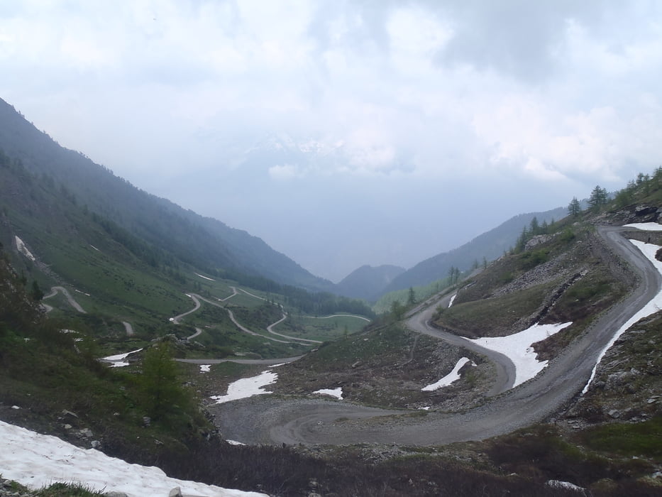
Ein langer Aufstig bis zum Col de Finestre von Susa, aber dann kommt eine grandiose Aussicht auf der Assietta-Kammstraße. Die Runde endete leider am Schnee


Túra fotóalbuma

Túratérkép és magasságprofil

  • Open Street Map
  • Google
Minimum height 467 m Maximum height 2212 m Részletes nézet

More about the tour author

haaaatz
Member since 2011

Send private message

Megjegyzések

GPS trackek

Trackpoints
  • GPX / Garmin Map Source (gpx) download
  • TCX / Garmin Training Center® (tcx) download
  • CRS / Garmin Training Center® (crs) download
  • Google Earth (kml) download
  • G7ToWin (g7t) download
  • TTQV (trk) download
  • Overlay (ovl) download
  • Fugawi (txt) download
  • Kompass (DAV) Track (tk) download
  • Túralap (pdf) download
  • Original file of the author (gpx) download

More about the tour author

haaaatz
Member since 2011

Send private message
Share track
Add to my favorites
Remove from my favorites
Edit tags
My score
Rate
Túra: Assietta
jelleg: Hegyi kerékpár
Hosszúság: 59,9 km
Evaluated on:
Tartam:
Day(s)
Hour(s)
Minute(s)
Értékelés: Vidék Szórakozás Kondíció Technika