


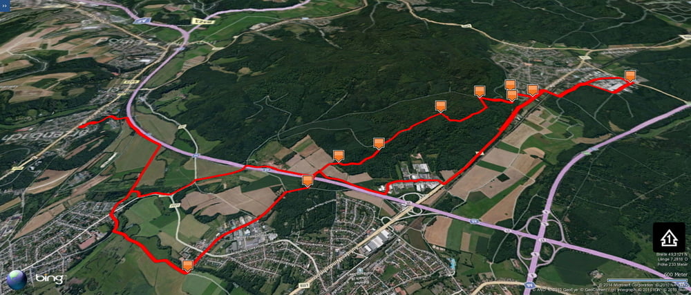
Wieder eine meiner Tagesvarianten zwischen Schwarzenbach und Kirkel.
Beim Rückweg fuhr ich den kurzen Weg zur Passhöhe oberhalb des Taubentals hoch und bog dort nach Westen ab und fuhr den linken Forstweg auf der Höhe entlang. Eine schöne Variante, besonders schön fand ich auch die Abfahrt durch den Hohlweg und das Wegstück hinunter zur Autobahnbrücke.
Further information at
https://de.wikipedia.org/wiki/Sankt_Ingbert-Kirkeler_WaldgebietTúra fotóalbuma
Túratérkép és magasságprofil
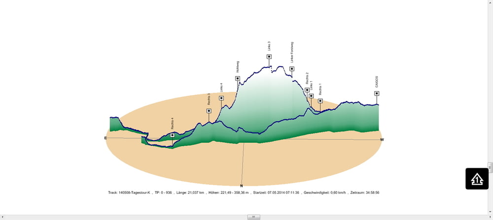
Minimum height 221 m
Maximum height 358 m
More about the tour author
|
|
Pheinz |
Megjegyzések

In Schwarzenbach geht es los.
GPS trackek
Trackpoints-
GPX / Garmin Map Source (gpx) download
-
TCX / Garmin Training Center® (tcx) download
-
CRS / Garmin Training Center® (crs) download
-
Google Earth (kml) download
-
G7ToWin (g7t) download
-
TTQV (trk) download
-
Overlay (ovl) download
-
Fugawi (txt) download
-
Kompass (DAV) Track (tk) download
-
Túralap (pdf) download
-
Original file of the author (gpx) download
More about the tour author
|
|
Pheinz |
Add to my favorites
Remove from my favorites
Edit tags
Open track
My score
Rate