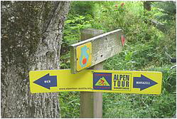
Tour includes nice long and windy single-trail from Parapluie Strecke all the way down ending in the beautiful Weinfelder of Perchtoldsdorf.
The way back is under the A21, simple but attractive trail to wasserspreng. from there you arrive on top of Parapluie again, singel trail trough the forest, over the P'dorfer Heide (guess it is not meant for bikes)
Túratérkép és magasságprofil
Minimum height 232 m
Maximum height 583 m
Megjegyzések

GPS trackek
Trackpoints-
GPX / Garmin Map Source (gpx) download
-
TCX / Garmin Training Center® (tcx) download
-
CRS / Garmin Training Center® (crs) download
-
Google Earth (kml) download
-
G7ToWin (g7t) download
-
TTQV (trk) download
-
Overlay (ovl) download
-
Fugawi (txt) download
-
Kompass (DAV) Track (tk) download
-
Túralap (pdf) download
-
Original file of the author (gpx) download
Add to my favorites
Remove from my favorites
Edit tags
Open track
My score
Rate


