Login

Elfelejtetted a jelszód?

Cookies have to be accepted!
Your browser's cookie functionality is disabled. Please enable this functionality.

Not a member yet?

Register now
Login

Available for registred users only

Log in to use this feature.

Elfelejtetted a jelszód?

Cookies have to be accepted!
Your browser's cookie functionality is disabled. Please enable this functionality.

Not a member yet?

Register now
Filter
Kategóriák
Advanced filters
  • Hosszúság (km)
  • Szintkülönbség
Szűrő elmentése Reset filter

TrackRank

QRCode

Technical data

Hosszúság30,7 km Szintkülönbség560 m Way down507 m Tartam01:50 h:m Dátum24.04.2009
Értékelések Author Vidék Szórakozás Kondíció Technika

Statisztika

681 Views 2 Értékelések 173 Letöltések 2.00 átlag
Rate
  • Túralap
  • Megközelítés
  • Letöltések

Beim Golfplatz unterhalb von Pfuhl geht's los.

Über die Donau -> Böfinger Halde hoch - voll mit Singletrails - bei Bedarf kann man

mehrere einstreuen. Über Thalfingen am Friedhof geht ein netter Trail bis Oberelchingen.

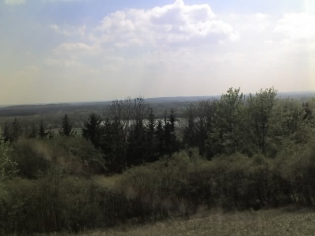
Anschließend nach Hörvelsingen zur Heide.(wunderbare Aussicht)

Zurück durch ein  Tal nach Böfingen.

Viel Spaß!


Túratérkép és magasságprofil

  • Open Street Map
  • Google
Minimum height 419 m Maximum height 585 m Részletes nézet

More about the tour author

pet22
Member since 2008

Send private message

Megjegyzések

von Ulm - Neu-Ulm - zwischen Offenhausen und Pfuhl - Kreisverkehr Richtung Donau Fa. Reinz - dort unten gibt's auch einen Parkplatz.

GPS trackek

Trackpoints
  • GPX / Garmin Map Source (gpx) download
  • TCX / Garmin Training Center® (tcx) download
  • CRS / Garmin Training Center® (crs) download
  • Google Earth (kml) download
  • G7ToWin (g7t) download
  • TTQV (trk) download
  • Overlay (ovl) download
  • Fugawi (txt) download
  • Kompass (DAV) Track (tk) download
  • Túralap (pdf) download
  • Original file of the author (gpx) download

More about the tour author

pet22
Member since 2008

Send private message
Share track
Add to my favorites
Remove from my favorites
Edit tags
My score
Rate
Túra: nette Abendrunde
jelleg: Hegyi kerékpár
Hosszúság: 30,7 km
Evaluated on:
Tartam:
Day(s)
Hour(s)
Minute(s)
Értékelés: Vidék Szórakozás Kondíció Technika