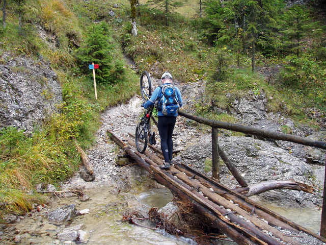
Von Pfronten fährt man an der Vils entlang zum Lechfall. Weiter geht die Strecke über Schluxen – Reutte zum Urisee. Vom Urisee fährt man weiter auf dem Dürrenberg Weg steil bergauf. An einem Wegweiser führt die Bikestrecke links zum Gehrebachtl. Nach der Querung der Schlucht mit anschließender kurzer Schiebepassage geht es weiter auf dem Altenbergweg zum Plansee. Gleich nach dem Campingplatz am See führt die Bikestrecke bergauf auf den Panoramaweg oberhalb der Fahrstraße. Nach dem der Panoramaweg verlassen wird geht es durchs Archbachtal hinab nach Reutte. Von Reutte fährt man auf dem Lechradweg bis Weißenbach und folgt dort dem Wegweiser "Alter Gaichtpass". Im Tannheimer Tal angelangt fährt man durch das landschaftliche schöne Hochtal ins Vilstal. Durchs Vilstal gehts zurück zum Ausgangspunkt nach Pfronten.
Túra fotóalbuma
Túratérkép és magasságprofil
Minimum height 764 m
Maximum height 1215 m
Megjegyzések

Startpunkt ist der Bahnhof in Pfronten
GPS trackek
Trackpoints-
GPX / Garmin Map Source (gpx) download
-
TCX / Garmin Training Center® (tcx) download
-
CRS / Garmin Training Center® (crs) download
-
Google Earth (kml) download
-
G7ToWin (g7t) download
-
TTQV (trk) download
-
Overlay (ovl) download
-
Fugawi (txt) download
-
Kompass (DAV) Track (tk) download
-
Túralap (pdf) download
-
Original file of the author (gpx) download
Add to my favorites
Remove from my favorites
Edit tags
Open track
My score
Rate


