Login

Elfelejtetted a jelszód?

Cookies have to be accepted!
Your browser's cookie functionality is disabled. Please enable this functionality.

Not a member yet?

Register now
Login

Available for registred users only

Log in to use this feature.

Elfelejtetted a jelszód?

Cookies have to be accepted!
Your browser's cookie functionality is disabled. Please enable this functionality.

Not a member yet?

Register now
Filter
Kategóriák
Advanced filters
  • Hosszúság (km)
  • Szintkülönbség
Szűrő elmentése Reset filter

TrackRank

QRCode

Technical data

Hosszúság18,0 km Szintkülönbség207 m Way down174 m Tartam01:05 h:m Dátum01.05.2007
Értékelések Author Vidék Szórakozás Kondíció Technika

Statisztika

717 Views Értékelések 110 Letöltések átlag
Rate
  • Túralap
  • Megközelítés
  • Letöltések
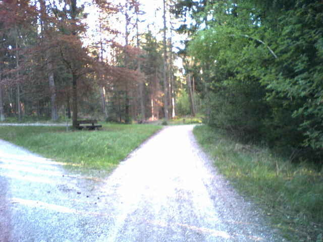
Schnelle einfache Tour, abseits der Straße, von Röthenbach nach Schwarzenbruck ist auch gut mit einem Fahrradanhänger zu machen.
Hat allerdings den Nachteil, dass alles Schotterpisten sind und dementsprechend staubig.

Túra fotóalbuma

Túratérkép és magasságprofil

  • Open Street Map
  • Google
Minimum height 332 m Maximum height 429 m Részletes nézet

More about the tour author

Matthias N
Member since 2005

Send private message

Megjegyzések

GPS trackek

Trackpoints
  • GPX / Garmin Map Source (gpx) download
  • TCX / Garmin Training Center® (tcx) download
  • CRS / Garmin Training Center® (crs) download
  • Google Earth (kml) download
  • G7ToWin (g7t) download
  • TTQV (trk) download
  • Overlay (ovl) download
  • Fugawi (txt) download
  • Kompass (DAV) Track (tk) download
  • Túralap (pdf) download

More about the tour author

Matthias N
Member since 2005

Send private message
Share track
Add to my favorites
Remove from my favorites
Edit tags
My score
Rate
Túra: von Röthenbach nach Schwarzenbruck express
jelleg: Trekkingbike
Hosszúság: 18,0 km
Evaluated on:
Tartam:
Day(s)
Hour(s)
Minute(s)
Értékelés: Vidék Szórakozás Kondíció Technika