
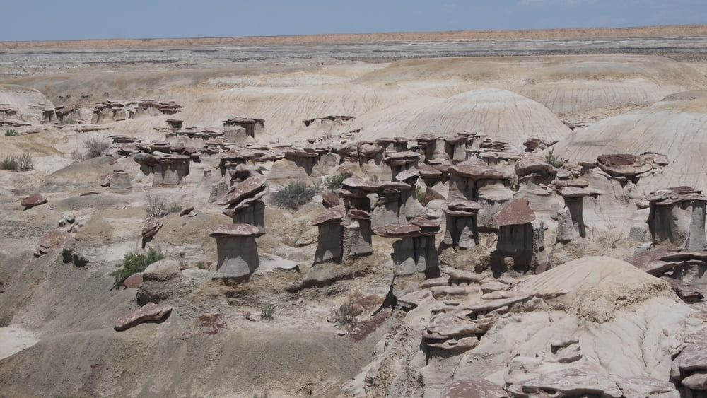

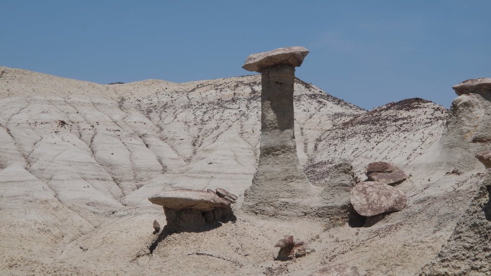
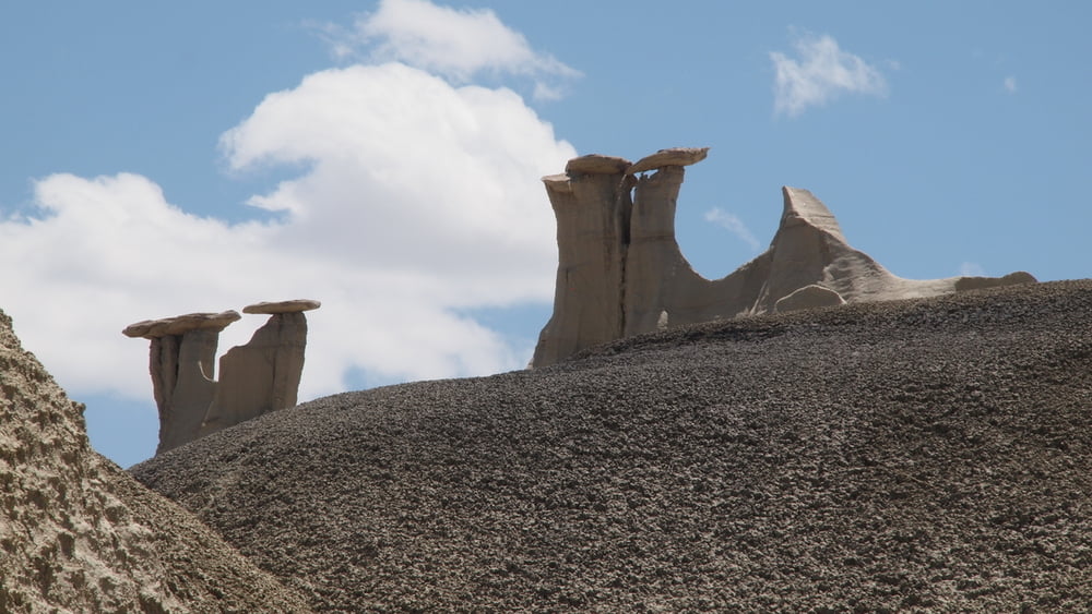
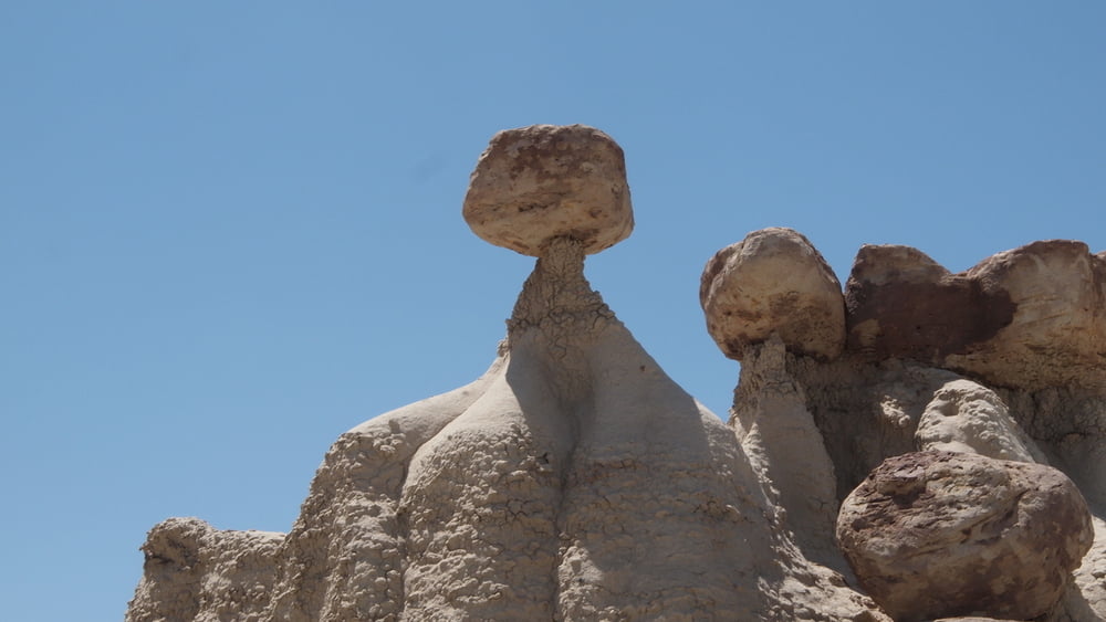
Ah-Shi-Sle-Pah is the hoodoo king of the San Juan Basin badlands.
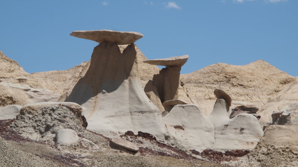
Multicolored badlands, eroded sandstone hoodoos and unique geological formations, many will love this place. A remote badland, but it offers the easiest hiking once you arrive.
Ah-Shi-Sle-Pah it’s a land of yellow cap rocks and scenic ochre or olive colored hills, beautiful and soft colors hardly seen elsewhere. True color names seen at Ah-Shi-Sle-Pah: burnt umber, yellow ochre, raw sienna, green oxide, burnt sienna, mars violet, charcoal grey, titanium white, red oxide and vermillion etc....Excellent, quiet area to make some beautiful pictures.
Galleria itinerari


Mappa itinerario e altimetria
Altezza minima 1857 m
Altezza massima 1896 m
Maggiori informazioni sull'autore del tour

|
willydn |
Commenti

Access: From Hwy 550, we used the route at Nageezi Is/Rt451 - Co/Rd7800 - Is/Rt452 - Hwy57, fully paved for a few miles, wide and well used for all the 12 miles to the junction with road 57, which is 3 miles from the trailhead.
Leave your car on Hwy57 and follow the trail for 0.6 mi to the old official parking place then further north until you reach the rim. Follow the gps track and you will find easily how to get down into the wilderness area.
Leave your car on Hwy57 and follow the trail for 0.6 mi to the old official parking place then further north until you reach the rim. Follow the gps track and you will find easily how to get down into the wilderness area.
Tracce GPS
Punti di traccia-
GPX / Garmin Map Source (gpx) download
-
TCX / Garmin Training Center® (tcx) download
-
CRS / Garmin Training Center® (crs) download
-
Google Earth (kml) download
-
G7ToWin (g7t) download
-
TTQV (trk) download
-
Overlay (ovl) download
-
Fugawi (txt) download
-
Kompass (DAV) Track (tk) download
-
Scheda tecnica (pdf) download
-
File originale dell'autore (gpx) download
Maggiori informazioni sull'autore del tour
|
|
willydn |
Aggiungi ai miei preferiti
Rimuovi dai miei preferiti
Modifica dei tag
Tour aperto
Il mio voto
Vota