Accesso

Hai dimenticato il login?

I cookie devono essere accettati!
La funzione cookie del suo browser è disattivata. Si prega di attivare la funzione.

Non sei ancora membro?

Registrati ora
Accesso

Possibile solo per gli utenti registrati

Effettua il login per poter utilizzare questa funzione.

Hai dimenticato il login?

I cookie devono essere accettati!
La funzione cookie del suo browser è disattivata. Si prega di attivare la funzione.

Non sei ancora membro?

Registrati ora
Filtro
Categorie
Filtri avanzati
  • Lunghezza (km)
  • Dislivello
Memorizza filtro Azzera il filtro

TrackRank

QRCode

Dati tecnici

Lunghezza23,0 km Dislivello0 m Discesa0 m Durata02:00 h:m Data30.08.2012
Valutazioni Autore Paesaggio Divertimento Condizione Tecnica

Statistica

183 Visualizzazioni Valutazioni 9 Download Media
Vota
  • Scheda tecnica
  • Come arrivare
  • Download

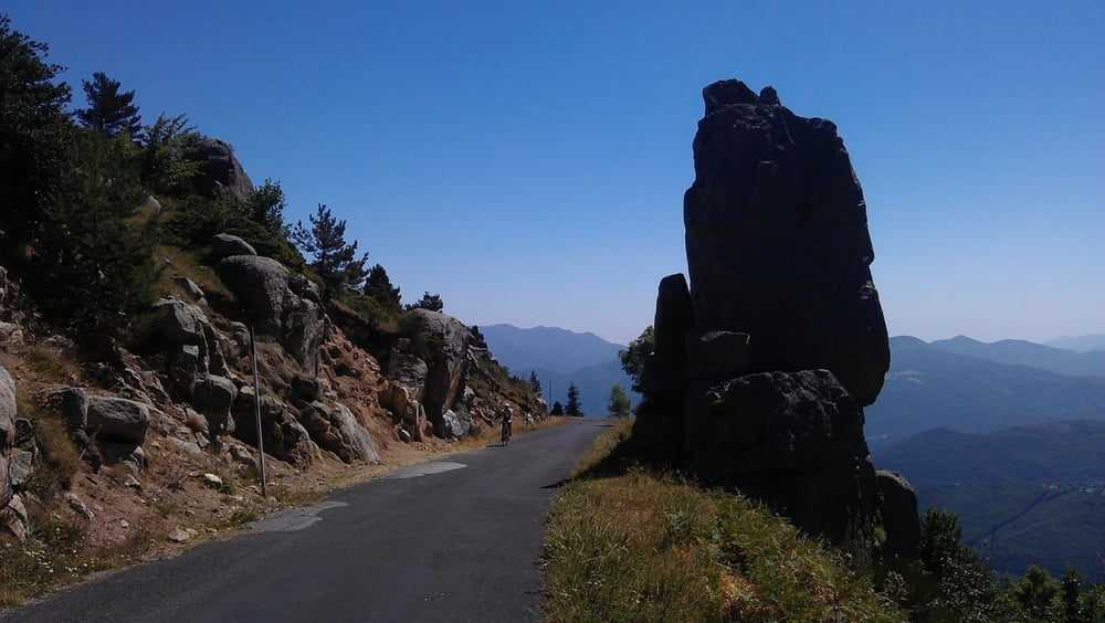
The first part of the uphill is quite steep and on sunny days you will be "kissed by the flame". The partially ruined "Église Saint-Martin de Corsavy" just before reaching the village of Corsavy is definitely worth a stop. In Corsavy refill your bottles at the fountain in the center, this will be your last chance to do so until you reach the Refuge de Batère. After Corsavy the road goes almost flat northward for some km's (nice to prepare for the final uphill).  After passing abandoned old mines and miner's homes you'll finally reach the "Refuge de Batère" (1450m) - enjoy a well earned rest up there (btw: the food is excellent).

If you want you can take a short hike on an unpaved road to the Tour the Batère (the old stone tower you've seen just before reaching the Refuge). The view from this old stone signaltower is stunning (look for other towers in sight, witch which the Tour the Batère was communicating in the past).

Mappa itinerario e altimetria

  • Open Street Map
  • Google
Altezza minima 99999 m Altezza massima -99999 m Vista dettagliata

Maggiori informazioni sull'autore del tour

DonSegafredo
Membro dal 2011

Invia un messaggio privato

Commenti

Start west of Arles sur Tech, where the D43 begins. If you came by car, you'll find some place to park there.

Tracce GPS

Punti di traccia
  • GPX / Garmin Map Source (gpx) download
  • TCX / Garmin Training Center® (tcx) download
  • CRS / Garmin Training Center® (crs) download
  • Google Earth (kml) download
  • G7ToWin (g7t) download
  • TTQV (trk) download
  • Overlay (ovl) download
  • Fugawi (txt) download
  • Kompass (DAV) Track (tk) download
  • Scheda tecnica (pdf) download
  • File originale dell'autore (gpx) download

Maggiori informazioni sull'autore del tour

DonSegafredo
Membro dal 2011

Invia un messaggio privato
Share track
Aggiungi ai miei preferiti
Rimuovi dai miei preferiti
Modifica dei tag
Il mio voto
Vota
Itinerario: To the Refuge de Batère
Tipo: Bicicletta da corsa
Lunghezza: 23,0 km
Valutato su:
Durata:
Giorni/Diurni
Ora/Ore
Minuti
Valutazione: Paesaggio Divertimento Condizione Tecnica