Accesso

Hai dimenticato il login?

I cookie devono essere accettati!
La funzione cookie del suo browser è disattivata. Si prega di attivare la funzione.

Non sei ancora membro?

Registrati ora
Accesso

Possibile solo per gli utenti registrati

Effettua il login per poter utilizzare questa funzione.

Hai dimenticato il login?

I cookie devono essere accettati!
La funzione cookie del suo browser è disattivata. Si prega di attivare la funzione.

Non sei ancora membro?

Registrati ora
Filtro
Categorie
Filtri avanzati
  • Lunghezza (km)
  • Dislivello
Memorizza filtro Azzera il filtro

TrackRank

QRCode

Dati tecnici

Lunghezza17,7 km Dislivello376 m Discesa371 m Durata00:00 h:m Data10.01.2005
Valutazioni Autore Paesaggio Divertimento Condizione Tecnica

Statistica

9946 Visualizzazioni 1 Valutazione 100 Download 3.00 Media
Vota
  • Scheda tecnica
  • Come arrivare
  • Download
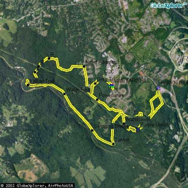
Poor drainage makes this ride horrible within 4 days of any rain, so take note. But, if there's a drought, you better make the time for this ride because it is awesome. Intermediates will enjoy the ride, and experts will love it! as long as somebody can stop M.O.R.E (a local club) from removing all the challenges of the ride. They tend to be overzealous in creating mountain biking everyone can enjoy at the expense of any advanced riders looking for a challenge.

Ulteriori informazioni sotto

http://www.raidoh.com

Mappa itinerario e altimetria

  • Open Street Map
  • Google
Altezza minima 35 m Altezza massima 142 m Vista dettagliata

Maggiori informazioni sull'autore del tour

Chad Schneider
Membro dal 2005

Invia un messaggio privato

Commenti

Local Avalon Rider on 20.02.2005

Mountainbike

It would help if you got your facts right: MORE works to make the trails sustainable, not remove challenges. In fact, they have added a lot of challenges. As you've noted, muddy conditions are rampant at Avalon which calls for proper trail design, something that did not happen when those trails were first developed.
To get to the Park-N-Ride, from I95, take the Catonsville MD166 Exit and follow the signs to the PNR. Landing Road is more complicated. From I95, take MD100 East. Go North on MD Rt 1 and take a left on Montgomery Road. Right on Landing Road. Go 4 miles, trails are on the right, new houses are on the left. A street name should be posted soon.

Tracce GPS

Punti di traccia
  • GPX / Garmin Map Source (gpx) download
  • TCX / Garmin Training Center® (tcx) download
  • CRS / Garmin Training Center® (crs) download
  • Google Earth (kml) download
  • G7ToWin (g7t) download
  • TTQV (trk) download
  • Overlay (ovl) download
  • Fugawi (txt) download
  • Kompass (DAV) Track (tk) download
  • Scheda tecnica (pdf) download
  • File originale dell'autore (g7t) download

Maggiori informazioni sull'autore del tour

Chad Schneider
Membro dal 2005

Invia un messaggio privato
Share track
Aggiungi ai miei preferiti
Rimuovi dai miei preferiti
Modifica dei tag
Il mio voto
Vota
Itinerario: Avalon
Tipo: Mountain bike
Lunghezza: 17,7 km
Valutato su:
Durata:
Giorni/Diurni
Ora/Ore
Minuti
Valutazione: Paesaggio Divertimento Condizione Tecnica