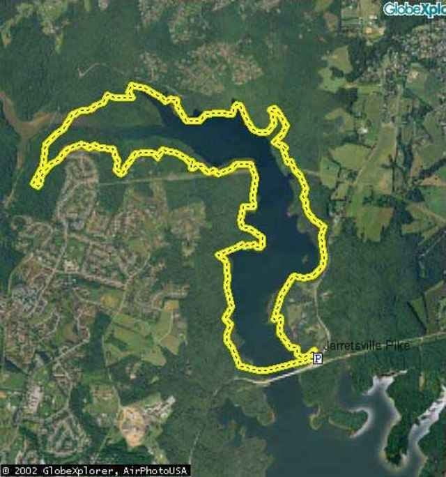
These trails are incredible single track just outside of Towson in Northern Baltimore. Not very much elevation, with a couple exceptions, but the scenery is beautiful and it's fast as well as technical. The Warren loop runs around the resevoir and covers about 10 miles, although there are additional trails to explore. Our route kept us off the road except for a 1/4 mile to the car, but that's only possible at lower water levels. The Dam Loop is another 10 miles with some great technical sections but a little more fireroad than Warren. The rides are definitely connectable, and after I get a GPS map of the Dam Loop, you'll know exactly how to do it...
Ulteriori informazioni sotto
http://www.raidoh.comMappa itinerario e altimetria
Altezza minima -23 m
Altezza massima 176 m
Commenti

From I-695 around Baltimore, take Dulaney Valley Road north. The Dam Loop starts by parking at the Church at Seminary Road. Take Seminary across Dulaney Valley and the trails are on the left at a gate. The Warren Loop starts another 5 miles up Dulaney Vallay. There is a parking lot and trailhead on the left just before you cross an 1/8 mile bridge. If you've passed Jarrettsville Pike, you've gone too far. If the lot is full, there is parking just as you get onto Jarrettsville Pike, and another trailhead straight across the intersection and over the guardrail.
Tracce GPS
Punti di traccia-
GPX / Garmin Map Source (gpx) download
-
TCX / Garmin Training Center® (tcx) download
-
CRS / Garmin Training Center® (crs) download
-
Google Earth (kml) download
-
G7ToWin (g7t) download
-
TTQV (trk) download
-
Overlay (ovl) download
-
Fugawi (txt) download
-
Kompass (DAV) Track (tk) download
-
Scheda tecnica (pdf) download
-
File originale dell'autore (g7t) download
Aggiungi ai miei preferiti
Rimuovi dai miei preferiti
Modifica dei tag
Tour aperto
Il mio voto
Vota


