Accesso

Hai dimenticato il login?

I cookie devono essere accettati!
La funzione cookie del suo browser è disattivata. Si prega di attivare la funzione.

Non sei ancora membro?

Registrati ora
Accesso

Possibile solo per gli utenti registrati

Effettua il login per poter utilizzare questa funzione.

Hai dimenticato il login?

I cookie devono essere accettati!
La funzione cookie del suo browser è disattivata. Si prega di attivare la funzione.

Non sei ancora membro?

Registrati ora
Filtro
Categorie
Filtri avanzati
  • Lunghezza (km)
  • Dislivello
Memorizza filtro Azzera il filtro

TrackRank

QRCode

Dati tecnici

Lunghezza122,7 km Dislivello2564 m Discesa2474 m Durata05:40 h:m Data08.09.2013
Valutazioni Autore Paesaggio Divertimento Condizione Tecnica

Statistica

481 Visualizzazioni Valutazioni 58 Download Media
Vota
  • Scheda tecnica
  • Come arrivare
  • Download

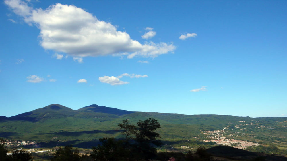
This tour will lead you from the medieval village of Pitigliano to the highest mountain of the Tuscany, the Monte Amiata. I tried to use as much small sideroads as possible to escape crazy Italian drivers, trailer towing Dutch drivers or Germans with a much too big SUV for their driving skills (so much about prejudices). Please be aware that the quality of some of the roads used is partially pretty poor with potholes in the bitumen. I did not climb up to the Peak of Mt. Amiata which would add another 100 vertical meters to the account and can only be done by walking.

I did the tour anticlockwise. It can be done clockwise as well but then you have to climb on roads which have more traffic. Altogether the climbs are never so steep that you have to get out of your saddle.

There are a couple of restaurants and bars near the top of Mt. Amiata but few on the way up or down. So plan your breaks well. There is no drinkable water along the road except what you buy in bars.

The tour will offer some excellent views on the landscape. As the Mt. Amiata itself is covered by wood, you get shade but only few possibilities to have a look around.

Galleria itinerari

Mappa itinerario e altimetria

  • Open Street Map
  • Google
Altezza minima 224 m Altezza massima 1672 m Vista dettagliata

Maggiori informazioni sull'autore del tour

Onkel Darwin
Membro dal 2007

Invia un messaggio privato

Commenti

The tour starts at Pitigliano with sometimes limited parking possibilities. You can choose any other place on the track for starting as well.

Tracce GPS

Punti di traccia
  • GPX / Garmin Map Source (gpx) download
  • TCX / Garmin Training Center® (tcx) download
  • CRS / Garmin Training Center® (crs) download
  • Google Earth (kml) download
  • G7ToWin (g7t) download
  • TTQV (trk) download
  • Overlay (ovl) download
  • Fugawi (txt) download
  • Kompass (DAV) Track (tk) download
  • Scheda tecnica (pdf) download
  • File originale dell'autore (gpx) download

Maggiori informazioni sull'autore del tour

Onkel Darwin
Membro dal 2007

Invia un messaggio privato
Share track
Aggiungi ai miei preferiti
Rimuovi dai miei preferiti
Modifica dei tag
Il mio voto
Vota
Itinerario: From Pitigliano to the Mt. Amiata
Tipo: Bicicletta da corsa
Lunghezza: 122,7 km
Valutato su:
Durata:
Giorni/Diurni
Ora/Ore
Minuti
Valutazione: Paesaggio Divertimento Condizione Tecnica