
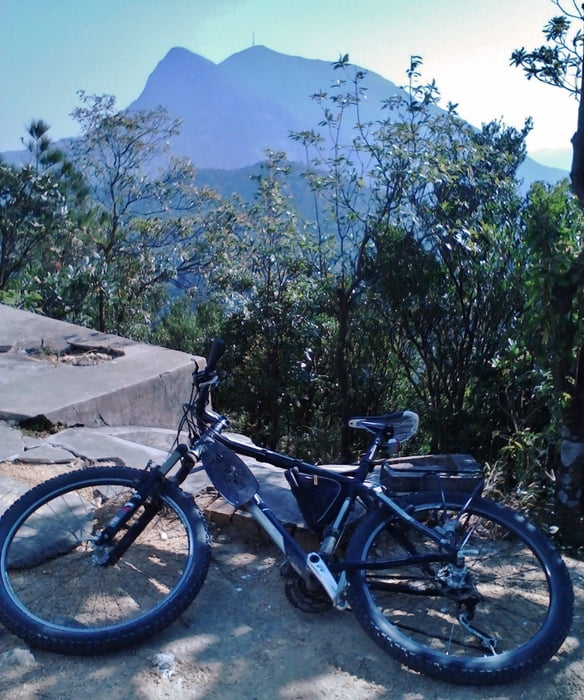

The ride from the WoHua in Taicheng firstly to the entrance of the BeiFengShan mountain park and then to the peak 532 m (steep but possible). The last part (approx. 80 m) - the stairs. On the top there is no other possibility to get down, so that you can leave the bike at the stairs. Nice view on the summit but lot of rabbish...
Then back to the main road and to the "via ferrata" (after you arrived the last pass, you have to ride down approx. 100 m, wchich you have accent again when riding home). Unfortunately, at the end of the trail (2 km after the "via ferrata"), there is no way down. On the next day, we tried to find it, but still could not finish it. May be later :). The "via ferrata" is very Chinese but amaising, just try. It seems to be a pretty small hiking trail alond the stream.
For the return, I have taken another way. It is strongly recommended to do this - clean, small, nice villages along the way. In the end however - 4 km along the federal way with the wide side lane - no problem to ride the way (10 - 15 min).
Galleria itinerari


Mappa itinerario e altimetria
Altezza minima
Altezza massima 520 m
Maggiori informazioni sull'autore del tour

|
py_dolfo |
Commenti

Tracce GPS
Punti di traccia-
GPX / Garmin Map Source (gpx) download
-
TCX / Garmin Training Center® (tcx) download
-
CRS / Garmin Training Center® (crs) download
-
Google Earth (kml) download
-
G7ToWin (g7t) download
-
TTQV (trk) download
-
Overlay (ovl) download
-
Fugawi (txt) download
-
Kompass (DAV) Track (tk) download
-
Scheda tecnica (pdf) download
-
File originale dell'autore (gpx) download
Maggiori informazioni sull'autore del tour
|
|
py_dolfo |
Aggiungi ai miei preferiti
Rimuovi dai miei preferiti
Modifica dei tag
Tour aperto
Il mio voto
Vota