

Wicklow Mountains sind in Irland schon ein Begriff in der Radsport-Szene und so bin ich im Nachhinein super froh darüber, dass ich noch einen Bikeshop gefunden habe wo ich mir ein Bike leihen konnte. Vermutlich habe ich mit meinen sehnsüchtigen Blicken derartiges Mitleid erzeugt, dass mir die Jungs wohl eines ihrer Privatbikes geliehen haben J
Die Jungs von Bespoke Cycles http://bespokecycles.ie/about-us sind superkompetent und extrem Freundlich!
Nochmals herzlichen Dank für das Bike und eure Tipps zur Streckenwahl
Erst mal aus der Stadt raus (10 Minuten) geht’s über herrliche Landschaften und langsam steigend ins bergige Hinterland.
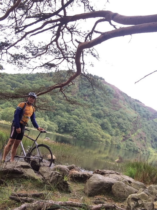
Ich radelte über Roundwood zur wohl berühmteste Klostersiedlung Irlands Glendalough mit seinen beiden Seen.
Zurück dann zunächst über eine einsame und aussichtsreiche Militärstraße über einen Teil der Shay Elliot Route zum Shay Elliot Memorial.
Shay war der erste Ire im gelben Trikot der Tour de France. Die Passstraße ist mit den typischen Motivationssprüchen beschriftet,- leider für mich in der Abfahrtsrichtung J .
Dieser Streckenabschnitt ist absolut einsam. Dringend genügend Verpflegung mitnehmen. Danach experimentiere ich mit meiner Karte herum, fahre kreuz und quer durch einsames Hinterland (an riesigen Herden glücklicher Kühe und Schafe vorbei), bis ich dann wieder auf eine größere Straße komme, auf der mich dann der krasse Rückenwind mit 45-50 Km/h zurück nach Wicklow peitscht J .
Viel Spaß
Ulteriori informazioni sotto
http://bespokecycles.ie/about-us/Galleria itinerari


Mappa itinerario e altimetria
Altezza minima 8 m
Altezza massima 381 m
Maggiori informazioni sull'autore del tour
|
|
UweEibel |
Commenti

Tracce GPS
Punti di traccia-
GPX / Garmin Map Source (gpx) download
-
TCX / Garmin Training Center® (tcx) download
-
CRS / Garmin Training Center® (crs) download
-
Google Earth (kml) download
-
G7ToWin (g7t) download
-
TTQV (trk) download
-
Overlay (ovl) download
-
Fugawi (txt) download
-
Kompass (DAV) Track (tk) download
-
Scheda tecnica (pdf) download
-
File originale dell'autore (gpx) download
Maggiori informazioni sull'autore del tour
|
|
UweEibel |
Aggiungi ai miei preferiti
Rimuovi dai miei preferiti
Modifica dei tag
Tour aperto
Il mio voto
Vota