Accesso

Hai dimenticato il login?

I cookie devono essere accettati!
La funzione cookie del suo browser è disattivata. Si prega di attivare la funzione.

Non sei ancora membro?

Registrati ora
Accesso

Possibile solo per gli utenti registrati

Effettua il login per poter utilizzare questa funzione.

Hai dimenticato il login?

I cookie devono essere accettati!
La funzione cookie del suo browser è disattivata. Si prega di attivare la funzione.

Non sei ancora membro?

Registrati ora
Filtro
Categorie
Filtri avanzati
  • Lunghezza (km)
  • Dislivello
Memorizza filtro Azzera il filtro

TrackRank

QRCode

Dati tecnici

Lunghezza17,2 km Dislivello683 m Discesa650 m Durata02:30 h:m Data18.09.2015
Valutazioni Autore User Paesaggio Divertimento Condizione Tecnica

Statistica

1406 Visualizzazioni 1 Valutazione 235 Download 4.00 Media
Vota
  • Scheda tecnica
  • Come arrivare
  • Download

Höhendifferenz: 670hm
Länge: 16km
Schwierigkeit: S1-2
Dauer: ca. 2,5h
Einkehrmöglichkeit: Rottach Egern, Kreuth

Hier gehts zum Touren Video:
https://www.youtube.com/watch?v=qwdGD_HqSjA

Wunderschöne Tour vorbei am Bauern in der Au. Mit mäßig steilen Anstiegen, hauptsächlich auf Feldwegen.
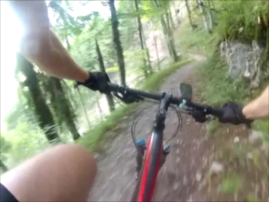
Das Highlight der Tour ist der durchgängig gut fahrbare Singletrail hinunter nach Kreuth. Anfangs noch etwas rauh, wird der Trail mit der Zeit immer flowiger.
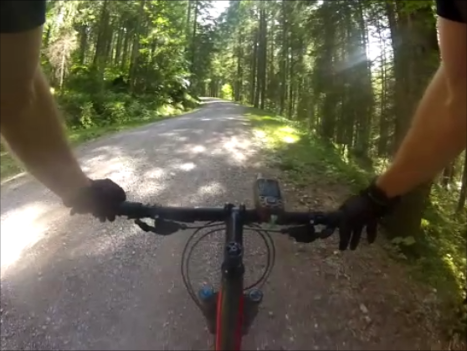
Zurück zum Auto empfiehlt sich der Weg entlang der Weißach oder auch einfach die 307.

Biker sind nicht überall gerne gesehen, freundlich Grüßen hilft fast immer!
Das Recht ist auf unserer Seite:
http://www.dimb.de/aktuelles/news-a-presse/798-bayvgh-radfahrverbot-aufgehoben


Ulteriori informazioni sotto

https://www.youtube.com/watch?v=qwdGD_HqSjA

Galleria itinerari

Mappa itinerario e altimetria

  • Open Street Map
  • Google
Altezza minima 767 m Altezza massima 1404 m Vista dettagliata

Maggiori informazioni sull'autore del tour

MTB_Venture
Membro dal 2015

Invia un messaggio privato

Commenti

Kanski on 16.07.2016

Nice single trail down!

We did the tour today 16-07-2016. Cloudy and about 18 degrees. The last week we've had a lot of rain in this part of Germany. On the up it's all Schotterweg through forest with now and then a beautiful view at the Landscape. The down is a nice single track. The top part in the forest was completely washed out and muddy. The rest was good.

Parkmöglichkeiten sind in der .gpx enthalten


Tracce GPS

Punti di traccia
  • GPX / Garmin Map Source (gpx) download
  • TCX / Garmin Training Center® (tcx) download
  • CRS / Garmin Training Center® (crs) download
  • Google Earth (kml) download
  • G7ToWin (g7t) download
  • TTQV (trk) download
  • Overlay (ovl) download
  • Fugawi (txt) download
  • Kompass (DAV) Track (tk) download
  • Scheda tecnica (pdf) download
  • File originale dell'autore (gpx) download

Maggiori informazioni sull'autore del tour

MTB_Venture
Membro dal 2015

Invia un messaggio privato
Share track
Aggiungi ai miei preferiti
Rimuovi dai miei preferiti
Modifica dei tag
Il mio voto
Vota
Itinerario: Hirschberg Trailtour
Tipo: Mountain bike
Lunghezza: 17,2 km
Valutato su:
Durata:
Giorni/Diurni
Ora/Ore
Minuti
Valutazione: Paesaggio Divertimento Condizione Tecnica