


Dit is de 8e en laatste dag van de fietstocht langs de Hadrianus muur en Wainwrights Coast to coast route. De low budget route gaat van camping naar camping. Het gedeelte langs de Hadrianus muur volgt de National Cycle Route 72 tot Carlisle. Na Carlisle buigt de track in richting van St. Bees, het startpunt van Wainwrights coast to coast van de Ierse zee naar de Noordzee.. Deze coast to coast route is van oorsprong een wandelpad. Ik heb geprobeerd om fietspaden en stille wegen op te nemen die zo dicht mogelijk bij de wandelroute liggen.
This is the eighth and last day of the cycle route along the Hadrian's Wall and Wainwrights Coast tot Coast.
The low budget route goes from campsite to campsite . The part along the Hadrian's Wall follows the National Cycle Route 72 till Carlisle. After Carlisle the track bends in the direction of St. Bees the starting point of Wainwrights Coast to Coast from the Irish sea to the North sea. This coast to coast route is a walking route. I tried to use cyclingpaths and quiet roads that are situated as near as possible to the walkingroute.
Galleria itinerari

Mappa itinerario e altimetria
Altezza minima 99999 m
Altezza massima -99999 m
Maggiori informazioni sull'autore del tour

|
partnair |
Commenti

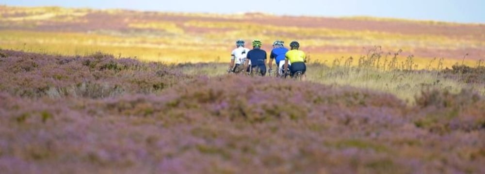
Deze etappe gaat door de North York moors. Een compleet ander landschap met moordende hellingen. Hier wordt gevloekt door de wielrenners en die hebben geen bagage mee omhoog te zeulen. 20 % hellingen omhoog en omlaag wachten op je. Rust op tijd even uit want tot Robin Hoods bay is er geen meter vlak.
De camping in Robin Hoods bay ligt voor het dorp. Het uitzicht over de Noordzee is fantastisch.
Het terrein is erg open. Er zijn weinig schuilmogelijkheden maar de eigenaars zijn erg vriendelijk en behulpzaam.
Let op: In het dorp is slechts 1 klein levensmiddelenwinkeltje. Restaurants zijn er volop.
Vergeet niet het steentje, dat je aan het strand in St. Bees opraapte, in de Noordzee te werpen en je schoen in de golven te dopen. YOU DID IT !!
This stage passes through the North York Moors. The landscape is completely different with killing hillslopes. Here the cyclists with light bicycles swear to the gods and they don't even have luggage to take up. Hillslopes of 20 % up and down are awaiting you. Take a break at the time because till Robin Hoods bay there is no flat yard.
The camping in Robin Hoods Bay is before the village. The view on the Northsea is fantastic.
The terrain is very open. There are almost no places to shelter, but the owners are very kind and helpfull.
Beware: In the village is only 1 tiny foodshop. Plenty of restaurants.
Don't forget to throw the pebble, that you picked up at the beach in St. Bees, into the North sea and to dip your shoe in the waves. YOU DID IT!!
Tracce GPS
Punti di traccia-
GPX / Garmin Map Source (gpx) download
-
TCX / Garmin Training Center® (tcx) download
-
CRS / Garmin Training Center® (crs) download
-
Google Earth (kml) download
-
G7ToWin (g7t) download
-
TTQV (trk) download
-
Overlay (ovl) download
-
Fugawi (txt) download
-
Kompass (DAV) Track (tk) download
-
Scheda tecnica (pdf) download
-
File originale dell'autore (gpx) download
Maggiori informazioni sull'autore del tour
|
|
partnair |
Aggiungi ai miei preferiti
Rimuovi dai miei preferiti
Modifica dei tag
Tour aperto
Il mio voto
Vota