

Als aanvulling op de tocht geef ik nog even de route naar de Ferry in (Kingston upon) Hull. Van daaruit vaar je naar Rotterdam Europoort (NL) of Zeebrugge (B). Wie naar Newcastle terug wil kan de National cycle Route 1 volgen in Noordelijke richting. De route vind je hier: http://www.sustrans.org.uk/ncn/map/route/route-1
Mappa itinerario e altimetria
Altezza minima 99999 m
Altezza massima -99999 m
Maggiori informazioni sull'autore del tour

|
partnair |
Commenti

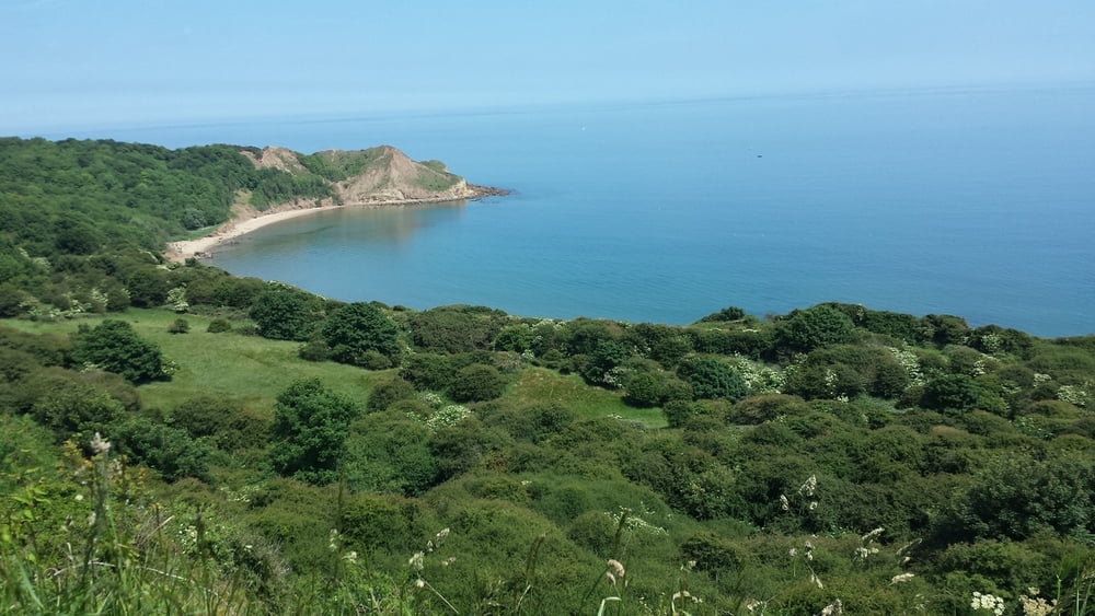
De tocht begint in Robin Hoods bay (dorp) en gaat over een redelijk ruig pad heel mild omhoog.
Geniet van de prachtige Noordzeekust.
Tussenstop op de camping van east end farm even na Driffield. Eevoudige boerencamping met een leuke uitbater.
as addition I give you the route to the Ferry in Hull. The boats sail to Rotterdam Europoort (NL) and Zeebrugge (B). Who wants to go back to Newcastle can folow the National Cycle Route 1 in Northern direction. You can find the Route here:http://www.sustrans.org.uk/ncn/map/route/route-1
The track starts in the village of Robin Hoods bay and go gently up over a rough path.
Enjoy the beautiful view on the Northsea coast.
Stopover on the campsite East end farm after Driffield. This is a simple Farm campsite with a lovely owner.
Tracce GPS
Punti di traccia-
GPX / Garmin Map Source (gpx) download
-
TCX / Garmin Training Center® (tcx) download
-
CRS / Garmin Training Center® (crs) download
-
Google Earth (kml) download
-
G7ToWin (g7t) download
-
TTQV (trk) download
-
Overlay (ovl) download
-
Fugawi (txt) download
-
Kompass (DAV) Track (tk) download
-
Scheda tecnica (pdf) download
-
File originale dell'autore (gpx) download
Maggiori informazioni sull'autore del tour
|
|
partnair |
Aggiungi ai miei preferiti
Rimuovi dai miei preferiti
Modifica dei tag
Tour aperto
Il mio voto
Vota