


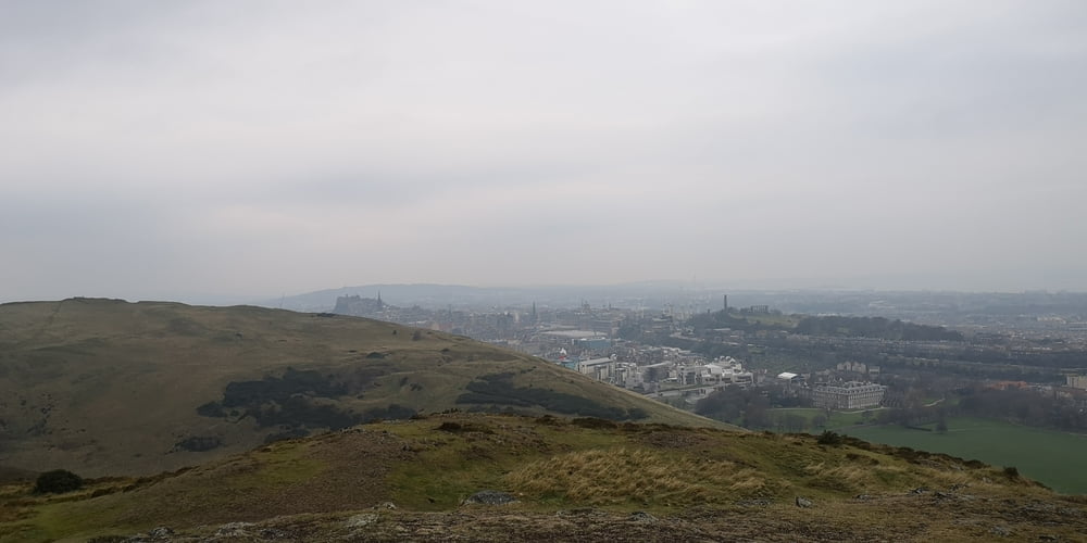
Arthur‘s Seat ist die höchste Erhebung mit 251m im Holyrood Park und das mitten in Edinburgh. Der Weg ist leicht zu finden. Trotzdem es nicht gerade eine Bergwanderung ist sollte man festes Schuhwerk haben und eine Winddichte Jacke. Ich war im Dezember oben und es blies ein sehr starker Wind.
Die Wanderung startet beim Friedhof. Von den Gräbern dieses Friedhofs lies sich die Harry Potter Autorin inspirieren was die Namen der Charaktere anbelangt. Vom Friedhof geht es zum Park The Meadows und von da zum Holyrood Park wo es dann etwas steil auf einem Pfad zum Arthur‘s Seat hochgeht. Hier hat man einen schönen Ausblick au die gesamte Stadt. Über Grashügel geht es dann wieder hinunter und an eine Kirchenruine vorbei. Unten angekommen geht es zur Residenz der Queen wenn sie in Schottland sein sollte. Von da aus geht es in Richtung Edinburgh Castle. Wer die Burg und die sehr schöne Victoria Street besuchen will geht gerade aus weiter auf der Royal Mile. Ich bin dann nach links abgebogen um das Nationalmuseum zu besuchen. Hier endet meine aufgezeichnete Tour.
Galleria itinerari


Mappa itinerario e altimetria
Altezza minima 34 m
Altezza massima 263 m
Maggiori informazioni sull'autore del tour
|
|
JoachimDief |
Commenti

Edinburgh Old Town Fiedhof Greyfriars Kirkyard bei Grassmarket
Tracce GPS
Punti di traccia-
GPX / Garmin Map Source (gpx) download
-
TCX / Garmin Training Center® (tcx) download
-
CRS / Garmin Training Center® (crs) download
-
Google Earth (kml) download
-
G7ToWin (g7t) download
-
TTQV (trk) download
-
Overlay (ovl) download
-
Fugawi (txt) download
-
Kompass (DAV) Track (tk) download
-
Scheda tecnica (pdf) download
-
File originale dell'autore (gpx) download
Maggiori informazioni sull'autore del tour
|
|
JoachimDief |
Aggiungi ai miei preferiti
Rimuovi dai miei preferiti
Modifica dei tag
Tour aperto
Il mio voto
Vota