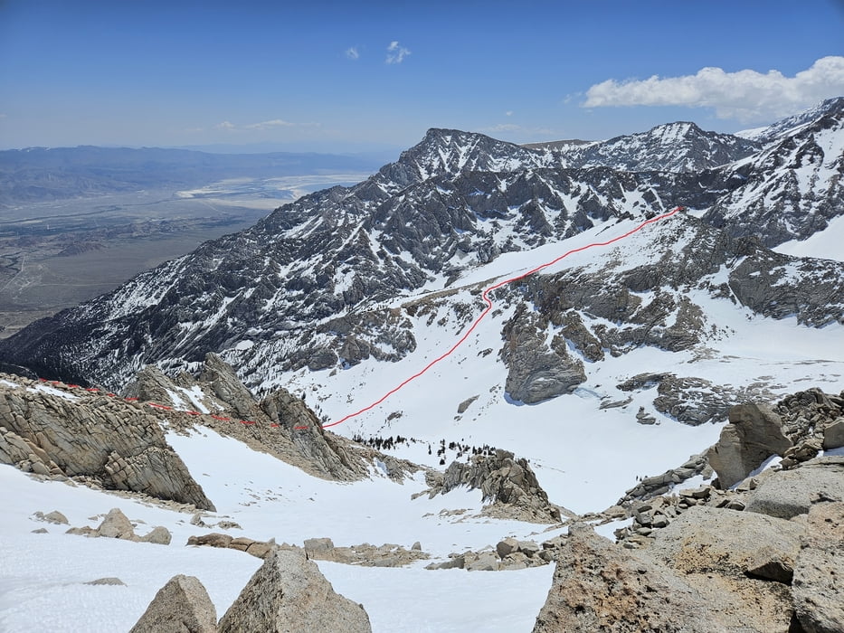
Tour im Rekordschneejahr 2023. Oft liegt der günstigste Termin, der gleich nach Öffnung der Portal road ist, schon 2-4 wochen früher. Offiziell sind für alle Touren im Witney Gebiet ein Permit (online buchbar) erforderlich. Um die Jahreszeit sind wir allerdings keinen Kontrollen begegnet. Für andere Touren in der Eastern Sierra / Inyo Wilderness ist ein Permit nur für Übernachtungen erforderlich (2023). Auch sind der Store, die Campingplätze etc. noch geschlossen solange die Wandersaison noch nicht eingesetzt hat. Trotzdem wird man schon einigen Fußgängern begegnen.
Vom Whitney Portal folgt man hinter dem Portal Store dem old Whitney trail entlang der Südseite des North Fork Lone Pine Creek. An der Jon Muir Wilderness Grenze hält man sich rechts und quert auf 2750 m nach rechts in die Rinne des North Fork Lone Pine Creek und in dieser empor. Bis hier muss damit gerechnet werden aus Schneemangel die Ski teilweise zu tragen. Nun landschaftlich hervorragend die breite Rinne zwischen den Granitwänden empor zum Lower Boy Scout Lake. Hier links die breite Flanke empor und oben den besten Durchschlupf durch die Felsenzone suchen. Evtl. ein paar Meter die Ski tragen. Dann nach rechts die flache Flanke hinauf in Richtung Gipfel. Zuletzt rechtshalted wird es nochmals steil. Die letzten Meter über Blockgelände zum Gipfel.
Galleria itinerari
Mappa itinerario e altimetria
Commenti

Tracce GPS
Punti di traccia-
GPX / Garmin Map Source (gpx) download
-
TCX / Garmin Training Center® (tcx) download
-
CRS / Garmin Training Center® (crs) download
-
Google Earth (kml) download
-
G7ToWin (g7t) download
-
TTQV (trk) download
-
Overlay (ovl) download
-
Fugawi (txt) download
-
Kompass (DAV) Track (tk) download
-
Scheda tecnica (pdf) download
-
File originale dell'autore (gpx) download


