
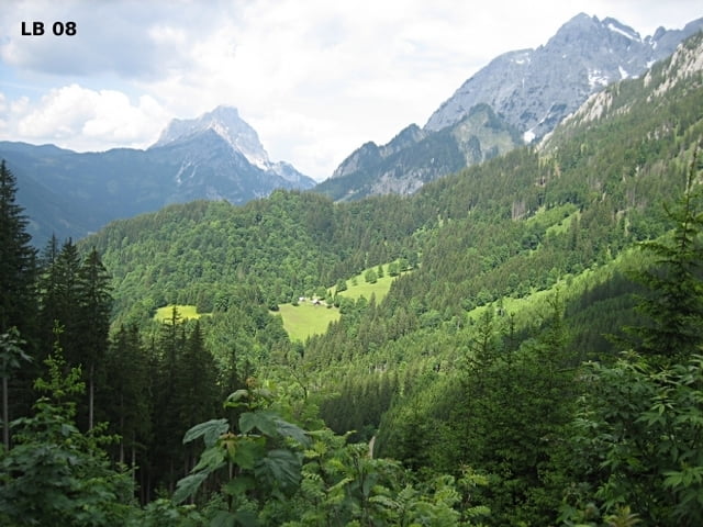

Die landschaftlich sehr interessante MTB - Tour im Johnsbachtal - Nationalpark Gesäuse bietet zwar nur acht Kilometer Forststraße, aber der Verkehr im Johnsbachtal ist so gering, dass er keineswegs stört. Und die Landschaft im engen Tal mit den 3 Almen im oberen Abschnitt dieser MTB - Tour sind absolut sehenswert. Insgesamt die Almbiketour Johnsbach als mittelschwer einzustufen und für jeden Mountainbiker sehr zu empfehlen.
Mehr Infos, Fotos und Video findest du auf - biketours4you.at
The scenery very interesting MTB - Tour Johnsbach - National park Gesäuse provides only eight km forest road, but the traffic in the Johnsbach valley is so low that it does not disturb. And the landscape in the narrow valley with three mountain pastures in the upper section of this MTB - Tour are absolutely worth seeing. Overall, the moderate classified Johnsbach biketour is highly recommended for any mountain biker.
More info, photo and video you'll find on - biketours4you.at
Galleria itinerari
Mappa itinerario e altimetria
Altezza minima 588 m
Altezza massima 1310 m
Maggiori informazioni sull'autore del tour
|
|
Trek1400d |
Commenti

Tracce GPS
Punti di traccia-
GPX / Garmin Map Source (gpx) download
-
TCX / Garmin Training Center® (tcx) download
-
CRS / Garmin Training Center® (crs) download
-
Google Earth (kml) download
-
G7ToWin (g7t) download
-
TTQV (trk) download
-
Overlay (ovl) download
-
Fugawi (txt) download
-
Kompass (DAV) Track (tk) download
-
Scheda tecnica (pdf) download
-
File originale dell'autore (gpx) download
Maggiori informazioni sull'autore del tour
|
|
Trek1400d |
Aggiungi ai miei preferiti
Rimuovi dai miei preferiti
Modifica dei tag
Tour aperto
Il mio voto
Vota