
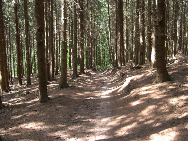

Deze tocht begint in de Commandeurstraat in Mechelen,waarna we op de kruising links gaan de elzetterweg op omhoog richting het elzetterbos en hierna verloopt de tocht hoofdzakelijk door het vijlenerbos met enkele leuke klimmen en een singletrail.
Er zit zeer weinig asphalt in de tour.......Let Op!.....als we op de terugweg de afdaling in het bos gehad hebben gaan we stukje over de asphaltweg en gelijk dan rechts een singletrail op die parralel aan de weg
Die tour startet in der commandeur Straße bei Mechelen, in dem auf wir auf der Verzweigung in den elzetterweg fahren Hier, nachdem wir fast zum Elzetterwald in der Richtung das vijlenerwald nahe zum vaalsbroek gehen. Dieser Ausflug geht das größte Teil in den vijlenerbos mit, welchen netten würzigen uphills. Lohnaufmerksamkeit zu! wenn wir nach stijle Abfall auf dem asphaltweg im vijlenerwood kommen, berichtigen Sie plötzlich das singletrail auf denen Ähnlichkeit zum Asphalt gegangenen Durchlauf. Dieses ist netter kleiner Ausflug.
The tour strats in the commandeur street at Mechelen where upon we on the junction left the elzetterweg go up. Here after we go to almost the Elzetterwood in direction the vijlenerwood near to vaalsbroek. This tour goes the largest part in the vijlenerbos with what nice spicy uphills. Pay attention to! if we come after stijle descent on the asphaltweg in the vijlenerwood, suddenly Right the singletrail on those parralel to the asphalt gone run. This is nice little tour.
Mappa itinerario e altimetria
Altezza minima 104 m
Altezza massima 343 m
Maggiori informazioni sull'autore del tour
|
|
BertAusten |
Commenti

Commandeurstraat - 6281 AM Mechelen - holland
Tracce GPS
Punti di traccia-
GPX / Garmin Map Source (gpx) download
-
TCX / Garmin Training Center® (tcx) download
-
CRS / Garmin Training Center® (crs) download
-
Google Earth (kml) download
-
G7ToWin (g7t) download
-
TTQV (trk) download
-
Overlay (ovl) download
-
Fugawi (txt) download
-
Kompass (DAV) Track (tk) download
-
Scheda tecnica (pdf) download
-
File originale dell'autore (gpx) download
Maggiori informazioni sull'autore del tour
|
|
BertAusten |
Aggiungi ai miei preferiti
Rimuovi dai miei preferiti
Modifica dei tag
Tour aperto
Il mio voto
Vota