


Hi Biker, this is one of my best Mtb ride, The first time I was here I should do a mtb tour looked on a map but during the climb I knew a local biker who took to me "no no bad idea, follow me" and I discovered this fantastic trail. I did it many many times
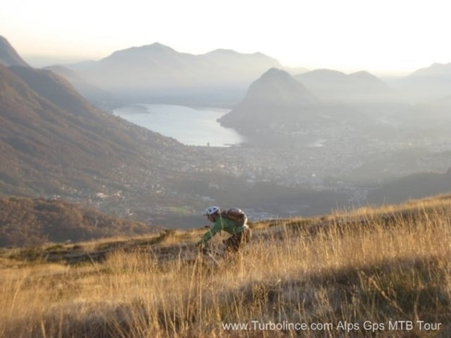
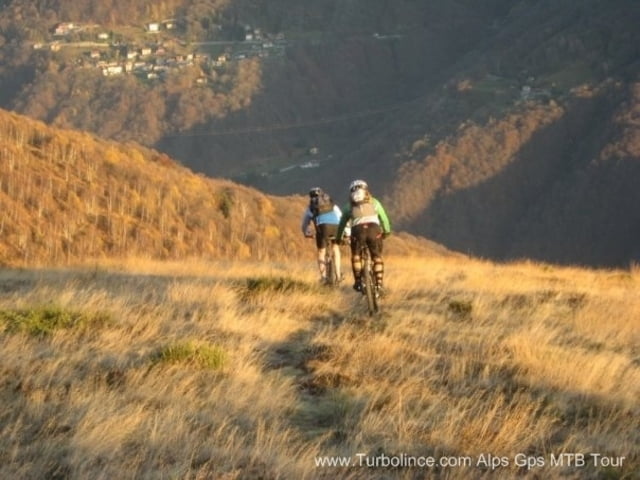
In short start from tesserete and climb on a car road , climb and climb and reach the capanna monte bar where many biker have a rest looking the beautifull panorama on Lugano .
Now you go forward on a dirty road and then take a short funny single trail on the right...enjoy it !!! reach a dirty road an turn right ( mind to the Scotland cow ) , you reach the some way you did in the climb side, redo the climb only up to the next bend, leave the asfalt road and ride trought a single trail ( you need to carry your bike for a little, but that is not a problem because your bike carry you for a long, can you carry your bike for a little? :-) ) this trail allow you to move towards the grass on the other side. Now go down toward the forest following the track and start a long long trail that carry you at the start point.
This explanation don't help you to do this tour, take care to use the gps.
Bye bye
other Alps Mtb gps track on www.turbolince.com
Galleria itinerari


Mappa itinerario e altimetria
Altezza minima 1841 m
Altezza massima 2920 m
Maggiori informazioni sull'autore del tour
|
|
Metadone |
Commenti

Start from Tesserete, a little town at the north of Lugano
Tracce GPS
Punti di traccia-
GPX / Garmin Map Source (gpx) download
-
TCX / Garmin Training Center® (tcx) download
-
CRS / Garmin Training Center® (crs) download
-
Google Earth (kml) download
-
G7ToWin (g7t) download
-
TTQV (trk) download
-
Overlay (ovl) download
-
Fugawi (txt) download
-
Kompass (DAV) Track (tk) download
-
Scheda tecnica (pdf) download
-
File originale dell'autore (gpx) download
Maggiori informazioni sull'autore del tour
|
|
Metadone |
Aggiungi ai miei preferiti
Rimuovi dai miei preferiti
Modifica dei tag
Tour aperto
Il mio voto
Vota