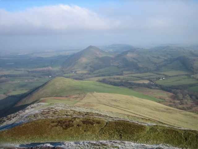
Caer Caradoc is a rounded hill sitting to the east of Church Stretton. It offers great views of the Long Mynd and the surrounding countryside all the way to Birmingham (on a clear day).
There are few trees and the wind can be strong so it's wise to bring something warm to wear.
This walk started in Church Stretton where there are shops and includes Caer Caradoc and Hope Bowder Hill, as well as Ragleth Hill. The last can be omitted easily to save time.
There are few trees and the wind can be strong so it's wise to bring something warm to wear.
This walk started in Church Stretton where there are shops and includes Caer Caradoc and Hope Bowder Hill, as well as Ragleth Hill. The last can be omitted easily to save time.
Ulteriori informazioni sotto
http://www.walkingbritain.co.uk/walks/walks7/w321.shtmlGalleria itinerari
Mappa itinerario e altimetria
Altezza minima 178 m
Altezza massima 469 m
Commenti

Start in the centre of Church Stretton, and head along Essex Road until you find a path leading off to the right, crossing the train track. Cross over the A49 and then straight ahead across a field, small road, and then another field towards Caer Caradoc. See the detailed instructions in the link.
Tracce GPS
Punti di traccia-
GPX / Garmin Map Source (gpx) download
-
TCX / Garmin Training Center® (tcx) download
-
CRS / Garmin Training Center® (crs) download
-
Google Earth (kml) download
-
G7ToWin (g7t) download
-
TTQV (trk) download
-
Overlay (ovl) download
-
Fugawi (txt) download
-
Kompass (DAV) Track (tk) download
-
Scheda tecnica (pdf) download
-
File originale dell'autore (gpx) download
Aggiungi ai miei preferiti
Rimuovi dai miei preferiti
Modifica dei tag
Tour aperto
Il mio voto
Vota


