Accesso

Hai dimenticato il login?

I cookie devono essere accettati!
La funzione cookie del suo browser è disattivata. Si prega di attivare la funzione.

Non sei ancora membro?

Registrati ora
Accesso

Possibile solo per gli utenti registrati

Effettua il login per poter utilizzare questa funzione.

Hai dimenticato il login?

I cookie devono essere accettati!
La funzione cookie del suo browser è disattivata. Si prega di attivare la funzione.

Non sei ancora membro?

Registrati ora
Filtro
Categorie
Filtri avanzati
  • Lunghezza (km)
  • Dislivello
Memorizza filtro Azzera il filtro

TrackRank

QRCode

Dati tecnici

Lunghezza27,5 km Dislivello408 m Discesa428 m Durata00:00 h:m Data26.04.2009
Valutazioni Autore Paesaggio Divertimento Condizione Tecnica

Statistica

1465 Visualizzazioni Valutazioni 147 Download Media
Vota
  • Scheda tecnica
  • Come arrivare
  • Download

MTB on Omberg

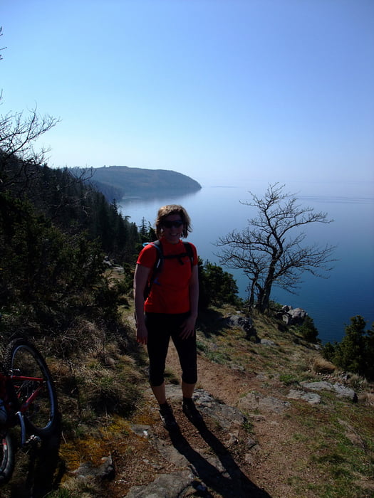
Omberg is beautifully situated by the shores of Lake Vättern. The flora is very varied and there are lots of flowers in spring time.

The forested hill Omberg is a popular area for outdoor avtivities and there are several hiking trails but not all of them suited for biking.Give way to walkers, be especially careful around the most popular areas around Hjässan, Ellen Key's Strand and Stocklycke.

The tour

This tour is best done clockwise and consists of a mixture of  trails (64%), gravel (17%) and tarmac (19%).

There are challanging climbs, fast and fun downhills, lovely views of Lake Vättern and the surrounding plains.

Today we started and ended the loop at Ellen Key's Strand. Other possible starting points are; Ombergs Turisthotell, Stocklycke, Storpissan or Hjässatorget.

Food breaks

If you don't BYO, tehe are lunch and snack possibilities en-route at Ombergs Turishotell and Stocklycke. Close to the trail are Borghamn and Hästholmen.

Places to stay

Try the web site "Tiderna landskap - A Spritual Haven" www.tidernaslandskap.se/Default.asp

Ulteriori informazioni sotto

http://www.sveaskog.se/Jakt-fiske-och-friluftsliv/besoksomraden/ekoparker/Ekopark-Omberg/

Galleria itinerari

Mappa itinerario e altimetria

  • Open Street Map
  • Google
Altezza minima 80 m Altezza massima 246 m Vista dettagliata

Maggiori informazioni sull'autore del tour

Eva
Membro dal 2006

Invia un messaggio privato

Commenti

derwolf on 24.08.2015

Great tour!

We did this thour beginning of August this year and it was really great! We started at the north end and did it clockwise. First some forrest roads for warm-up, then trails, trails, trails in such a beautiful landscape. Definitely one of the best MTB tours I ever did in Sweden! Thanks a lot for tracking it.

Tracce GPS

Punti di traccia
  • GPX / Garmin Map Source (gpx) download
  • TCX / Garmin Training Center® (tcx) download
  • CRS / Garmin Training Center® (crs) download
  • Google Earth (kml) download
  • G7ToWin (g7t) download
  • TTQV (trk) download
  • Overlay (ovl) download
  • Fugawi (txt) download
  • Kompass (DAV) Track (tk) download
  • Scheda tecnica (pdf) download
  • File originale dell'autore (gpx) download

Maggiori informazioni sull'autore del tour

Eva
Membro dal 2006

Invia un messaggio privato
Share track
Aggiungi ai miei preferiti
Rimuovi dai miei preferiti
Modifica dei tag
Il mio voto
Vota
Itinerario: MTB on Omberg
Tipo: Mountain bike
Lunghezza: 27,5 km
Valutato su:
Durata:
Giorni/Diurni
Ora/Ore
Minuti
Valutazione: Paesaggio Divertimento Condizione Tecnica