
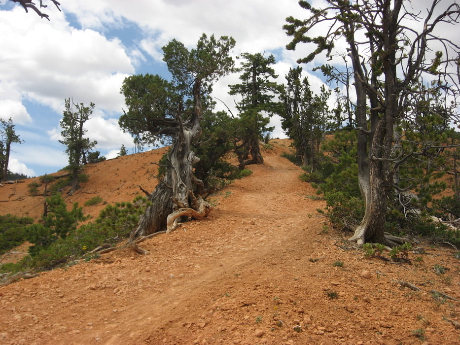

This route is spectacular. I rode it starting at the Red Canyon visitor center riding east on the bicycle trail next to highway 12. This part is nothing special and neither is the dirt road you take a right on. At the end of that dirt road the single track starts up in the woods. This is a nice fairly technical track where you can have some good fun. But the track gets really special once you hit the red rocks. The track gets really steep with hairpin turns through spectacular red rock scenary.
I rented a bike at Ruby's Inn at Bryce Canyon National Park. They only had hard tails and all of them were in need of maintenance. When we were there they didn't have many rented out yet, so we could pick the best ones. They only had two with disc brakes, but both clearly needed new brake pads. So we took bikes with v-brakes. Those were adquate for the majority of the trail, but in the red rocks section of the trail, you really actually need disk brakes. I did the trail in dry conditions and I wouldn't do it on the same bike in wet conditions. However, the closest place that rents out proper MTBs I could find was in Escalante, which is quite a bit away from Bryce.Galleria itinerari


Mappa itinerario e altimetria
Altezza minima 2172 m
Altezza massima 2532 m
Maggiori informazioni sull'autore del tour

|
jvdijk99 |
Commenti

Tracce GPS
Punti di traccia-
GPX / Garmin Map Source (gpx) download
-
TCX / Garmin Training Center® (tcx) download
-
CRS / Garmin Training Center® (crs) download
-
Google Earth (kml) download
-
G7ToWin (g7t) download
-
TTQV (trk) download
-
Overlay (ovl) download
-
Fugawi (txt) download
-
Kompass (DAV) Track (tk) download
-
Scheda tecnica (pdf) download
-
File originale dell'autore (gpx) download
Maggiori informazioni sull'autore del tour
|
|
jvdijk99 |
Aggiungi ai miei preferiti
Rimuovi dai miei preferiti
Modifica dei tag
Tour aperto
Il mio voto
Vota