
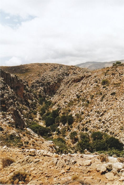

This is a hiking-track in the area of Kato Zakros (Eastern End of Crete).
It is a nice round-trip offering panoramic views into the famous Gorge of Dead. The northern part of the track should be followed first, because it runs in the landscape above the gorge, whereas the southern part of the walk runs down through the gorge itself. Down in the gorge the walk also leads past the remains of the rarely visited Minoan settlement of Lenika and a climbing-detour to a Minoan Fort (Kastelas).
The walk is very well waymarked with signs and red dots (special thanks to Stella's Traditional in Kato Zakros!), and it is fairly easy to walk. However, at one point in the gorge you will have to resort to climbing down about 10 meters of a rock cliff, assisted by a few iron handholds. Therefore the walk is not suitable for children.
Take a good amount of water with you, because there is virtually no shadow on the way.
Ulteriori informazioni sotto
http://www.stelapts.com/Galleria itinerari


Mappa itinerario e altimetria
Altezza minima 9 m
Altezza massima 226 m
Maggiori informazioni sull'autore del tour
|
|
Kretakulk |
Commenti

Drive down to Kato Zakros and continue past the Taverns at the beach and follow the sign towards the archeological site of Kato Zakros. Drive past the Minoan palace to the mouth of the Gorge of Dead (at the right side). Some meters before the entrance to the Gorge is a wooden signpost pointing towards Azokeramos and Mt. Traostalos. This is the beginning of the track.
Tracce GPS
Punti di traccia-
GPX / Garmin Map Source (gpx) download
-
TCX / Garmin Training Center® (tcx) download
-
CRS / Garmin Training Center® (crs) download
-
Google Earth (kml) download
-
G7ToWin (g7t) download
-
TTQV (trk) download
-
Overlay (ovl) download
-
Fugawi (txt) download
-
Kompass (DAV) Track (tk) download
-
Scheda tecnica (pdf) download
-
File originale dell'autore (gpx) download
Maggiori informazioni sull'autore del tour
|
|
Kretakulk |
Aggiungi ai miei preferiti
Rimuovi dai miei preferiti
Modifica dei tag
Tour aperto
Il mio voto
Vota