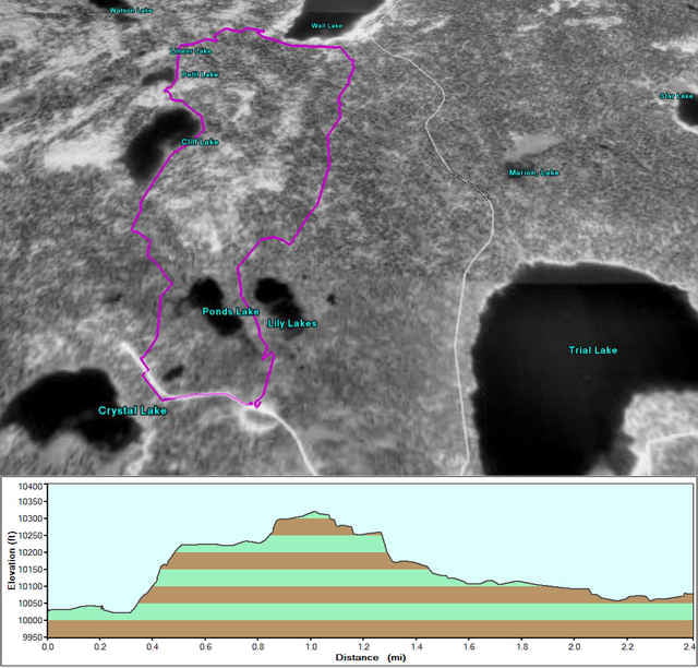
This is approximately half the Clyde Lake hike. Rather than hiking up to Clyde Lake it cuts across the south end of Wall Lake and back to the trailhead.
The hike begins slightly above 10,000 feet so if you're not used to the high elevation, be prepared to stop and catch your breath often.
The hike begins slightly above 10,000 feet so if you're not used to the high elevation, be prepared to stop and catch your breath often.
Mappa itinerario e altimetria
Altezza minima 3055 m
Altezza massima 3146 m
Commenti

Crystal Lake Trailhead.
Tracce GPS
Punti di traccia-
GPX / Garmin Map Source (gpx) download
-
TCX / Garmin Training Center® (tcx) download
-
CRS / Garmin Training Center® (crs) download
-
Google Earth (kml) download
-
G7ToWin (g7t) download
-
TTQV (trk) download
-
Overlay (ovl) download
-
Fugawi (txt) download
-
Kompass (DAV) Track (tk) download
-
Scheda tecnica (pdf) download
-
File originale dell'autore (gpx) download
Aggiungi ai miei preferiti
Rimuovi dai miei preferiti
Modifica dei tag
Tour aperto
Il mio voto
Vota


