Accesso

Hai dimenticato il login?

I cookie devono essere accettati!
La funzione cookie del suo browser è disattivata. Si prega di attivare la funzione.

Non sei ancora membro?

Registrati ora
Accesso

Possibile solo per gli utenti registrati

Effettua il login per poter utilizzare questa funzione.

Hai dimenticato il login?

I cookie devono essere accettati!
La funzione cookie del suo browser è disattivata. Si prega di attivare la funzione.

Non sei ancora membro?

Registrati ora
Filtro
Categorie
Filtri avanzati
  • Lunghezza (km)
  • Dislivello
Memorizza filtro Azzera il filtro

TrackRank

QRCode

Dati tecnici

Lunghezza34,3 km Dislivello1212 m Discesa1201 m Durata04:00 h:m Data09.08.2006
Valutazioni Autore Paesaggio Divertimento Condizione Tecnica

Statistica

4220 Visualizzazioni 4 Valutazioni 762 Download 2.50 Media
Vota
  • Scheda tecnica
  • Come arrivare
  • Download
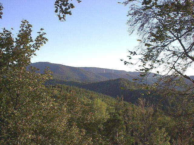
Die Tour führt auf Forstwegen und Singletrails von Freiburg-Wiehre über den Kibfelsen zum Aussichtsturm auf dem Schauinsland. Zurück geht es über Eduardshöhe und Luisenhöhe.
Anfang und Ende sind in der Nähe des Wiehrebahnhofs in der Türkenlouisstraße. Dort befindet sich eine kleine Überführung über die Bahngleise.
Der Link unten beschreibt eine ähnliche Tour; nicht diese Tour. Da dort aber einige Bilder zu finden sind, kann man sich auf dieser Seite einen guten ersten Eindruck verschaffen.
Viel Spass.

Ulteriori informazioni sotto

http://www.vbc-wt.de/breitensport/mtb_freiburg_schauinslandtour.htm

Mappa itinerario e altimetria

  • Open Street Map
  • Google
Altezza minima 292 m Altezza massima 1293 m Vista dettagliata

Maggiori informazioni sull'autore del tour

alho
Membro dal 2006

Invia un messaggio privato

Commenti

Hans-Peter on 24.09.2006

Tourbewertung

Sehr schöne Auffahrt zum Kybfelsen und zum Schauinsland. Abfahrt könnte noch mehr über Singletrails laufen, ist aber streckenweise recht anspruchsvoll! Ansonsten schöne Tour!
Rick on 06.07.2007

Mountain Biking

I only rode a small portion of this route, but think it could be much better. I went to the start point and found it was a fire road. I decided to jump onto the nearest single track/single trail and boy what a difference! Stick to the yellow or blued diamond routes and you'll have much mroe fun. I also discovered many unmarked single track that you can ride that will be much more fun than the fire roads. Go to the lake, ride up on the fire road a short way until you find the first side trail, and get on that. The single track is a little technical and requires some skill, but nothing too bad. You'll see lots of tire tracks to guide your way. Be sure to slow down around hikers. I put a bell on my bike to warn them and they always seem friendly. Have fun!
Lorenz on 18.08.2007

Coole Uphill-Singletrails

Erstmal schön Waldautobahn zum warmwerden und dann einfach nur ein fast nicht enden wollender Singletrail. Kommt fett. Bikebeherrschung insbesondere bei nassen Witterungsverhältnissen erforderlich. Achtung bei der Abfahrt, längere Wurzelpassage, im Trockenen aber super zu fahren. (Haben die Tour 2 mal gefahren, weil beim ersten mal nur Nebel und null Sicht. Bei gutem Wetter aber top Panoramafotos möglich!
Zennix on 03.05.2009

Alles dabei

Das letzte Stück zum Schauinsland hat mich noch ein local überredet von der Waldautobahn auf einen Singletrail auszuweichen. Coole Sache. Vom Trail direkt in die Stadt, habe ich öfter schon gelesen aber nicht geglaubt. Jetzt glaub ichs. Alles in Allem eine runde Sache diese Tour. Kann ich nur empfehlen. Für Freiburg Newbies (wie mich) ein absolutes Must have.
terje on 01.07.2011

sorry aber das geht nicht !

Bin am Wochenende diese Tour gefahren und muss leider sagen das diese Tour meiner Meinung nach der absolute Totalausfall ist ,ich war sowas von genervt und dachte zuerst ich bin die Tour falsch herum gefahren ,Singeltrails hoch und Wald bzw. Wiesenwege hinunter ,hätte ja gleich mit der Bahn runterfahren können, naja wers mag .
Für mich ein Tipp an die Leute die eher gerne Trails hinunter fahren > die Tour einfach andersrum fahren .


In Freiburg im Breisgau ins Stadtteil Wiehre. Der Start ist in der Nähe des Wiehrebahnhofs.

Tracce GPS

Punti di traccia
  • GPX / Garmin Map Source (gpx) download
  • TCX / Garmin Training Center® (tcx) download
  • CRS / Garmin Training Center® (crs) download
  • Google Earth (kml) download
  • G7ToWin (g7t) download
  • TTQV (trk) download
  • Overlay (ovl) download
  • Fugawi (txt) download
  • Kompass (DAV) Track (tk) download
  • Scheda tecnica (pdf) download
  • File originale dell'autore (gpx) download

Maggiori informazioni sull'autore del tour

alho
Membro dal 2006

Invia un messaggio privato
Share track
Aggiungi ai miei preferiti
Rimuovi dai miei preferiti
Modifica dei tag
Il mio voto
Vota
Itinerario: Von Freiburg über Kibfelsen zum Schauinsland
Tipo: Mountain bike
Lunghezza: 34,3 km
Valutato su:
Durata:
Giorni/Diurni
Ora/Ore
Minuti
Valutazione: Paesaggio Divertimento Condizione Tecnica