


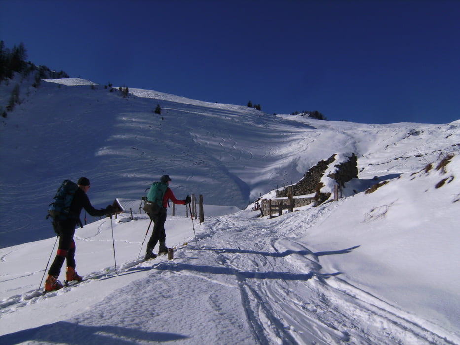
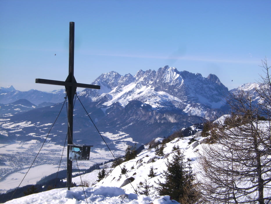
Eine nette Skitour im Lindtal westlich von St. Ulrich am Pillersee mit zwei sehr aussichtsreichen Gipfeln. Gemütlicher Einstieg auf einer Forststraße, mit zwei Gegenanstiegen doch lohnend. Die Sicht zu den umliegenden Bergen (Kaiser, Kitzbühler Horn, vor allen Dingen in die Loferer Steinberge) ist überwältigend. Nach Süden Sicht von der Goldberggruppe über Glockner bis Großvenediger.
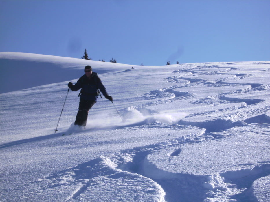
Parken auf einem kleinen PP unmittelbar am Beginn der Tour. Zunächst auf einer Forststraße gemütlich ins Lindtal und dort unter der Lindtalalm auf die rechte , sonnige Seite. Am Hang entlang bis zur Winterstelleralm und in den westlich liegenden Sattel. Dann rechts Anstieg zum Gerstberg, 1661m. Die unberührten Hänge Richtung Gerstbergalmen waren zu verlockend, wir fuhren 200 HM Richtung Gerstbergalm ab und gingen dann zurück zum Gipfel. Abfahrt zum Wegpunkt "Sattel" und ein weiteres mal auffellen. Dann in einigen Spitzkehren zum Waller Berg, ca. 1690m. Abfahrt nun auf der orographisch rechten Bachseite und ab der Lindtalalm auf der Forststraße.
Aufzeichnung des GPS: 1250 Hm, 3 Std. Gesamt Geh- und Abfahrtzeit, 1 ½ Std. Pausen
Ulteriori informazioni sotto
http://www.pillerseetal.at/de/winter/Galleria itinerari

Mappa itinerario e altimetria
Altezza minima 840 m
Altezza massima 1697 m
Maggiori informazioni sull'autore del tour
|
|
herzi |
Commenti

Anfahrt von D: BAB Ausfahrt Siegsdorf – Inzell – Lofer – Waidring – St. Ullrich am Pillersee
Tracce GPS
Punti di traccia-
GPX / Garmin Map Source (gpx) download
-
TCX / Garmin Training Center® (tcx) download
-
CRS / Garmin Training Center® (crs) download
-
Google Earth (kml) download
-
G7ToWin (g7t) download
-
TTQV (trk) download
-
Overlay (ovl) download
-
Fugawi (txt) download
-
Kompass (DAV) Track (tk) download
-
Scheda tecnica (pdf) download
-
File originale dell'autore (gpx) download
Maggiori informazioni sull'autore del tour
|
|
herzi |
Aggiungi ai miei preferiti
Rimuovi dai miei preferiti
Modifica dei tag
Tour aperto
Il mio voto
Vota