Accesso

Hai dimenticato il login?

I cookie devono essere accettati!
La funzione cookie del suo browser è disattivata. Si prega di attivare la funzione.

Non sei ancora membro?

Registrati ora
Accesso

Possibile solo per gli utenti registrati

Effettua il login per poter utilizzare questa funzione.

Hai dimenticato il login?

I cookie devono essere accettati!
La funzione cookie del suo browser è disattivata. Si prega di attivare la funzione.

Non sei ancora membro?

Registrati ora
Filtro
Categorie
Filtri avanzati
  • Lunghezza (km)
  • Dislivello
Memorizza filtro Azzera il filtro

TrackRank

QRCode

Dati tecnici

Lunghezza34,2 km Dislivello217 m Discesa215 m Durata02:00 h:m Data30.01.2010
Valutazioni Autore Paesaggio Divertimento Condizione Tecnica

Statistica

377 Visualizzazioni Valutazioni 26 Download Media
Vota
  • Scheda tecnica
  • Come arrivare
  • Download

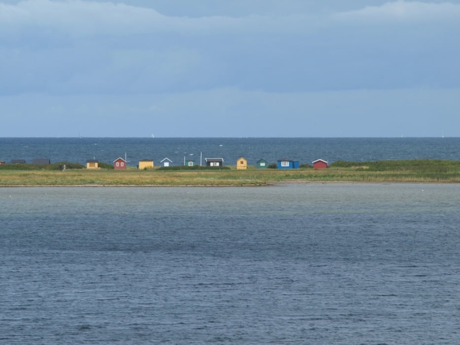
The tour starts at the ferry terminal of Ærøskøbing and follows along small country roads and through little villages over the eastern part of the island to Marstal. In Bregninge you may wish to visit the church with paintings from around 1510 or take a break in the nice café Den Grønne Gren where a smell of newly baked bread and coffee is always in the air. On the way, Voderup Klint is worth visiting. The moraine cliff is one of the most spectacular natural places on Ærø and offers a unique panorama. Sometimes step-shaped terraces of pasture gently slip down on layers of greasy grey clay in the underground. These landslides are so smoothly that - it is said - even the cows did not stop grazing during such an incident while sliding down 14 meters together with the land.

(a tour by dinau)

Ulteriori informazioni sotto

http://www.aeroeisland.com/

Galleria itinerari

Mappa itinerario e altimetria

  • Open Street Map
  • Google
Altezza minima -4 m Altezza massima 55 m Vista dettagliata

Maggiori informazioni sull'autore del tour

dinau
Membro dal 2009

Invia un messaggio privato

Commenti

Tracce GPS

Punti di traccia
  • GPX / Garmin Map Source (gpx) download
  • TCX / Garmin Training Center® (tcx) download
  • CRS / Garmin Training Center® (crs) download
  • Google Earth (kml) download
  • G7ToWin (g7t) download
  • TTQV (trk) download
  • Overlay (ovl) download
  • Fugawi (txt) download
  • Kompass (DAV) Track (tk) download
  • Scheda tecnica (pdf) download
  • File originale dell'autore (gpx) download

Maggiori informazioni sull'autore del tour

dinau
Membro dal 2009

Invia un messaggio privato
Share track
Aggiungi ai miei preferiti
Rimuovi dai miei preferiti
Modifica dei tag
Il mio voto
Vota
Itinerario: Island of Ærø
Tipo: Itinerari in bicicletta
Lunghezza: 34,2 km
Valutato su:
Durata:
Giorni/Diurni
Ora/Ore
Minuti
Valutazione: Paesaggio Divertimento Condizione Tecnica