


This tour was record with Garmin Colorado 300 and post-worked with Map Source.
For the famous Sella-Ronda you have two possibilities, in a clockwise circle “Orange” or in a counter clockwise circle “Green”. Both trails are about close to 50 km in total and are very nice. My favorite is the orange one - with the reason: the green one has a very long lifting part from Covara up to the Grödner Joch.
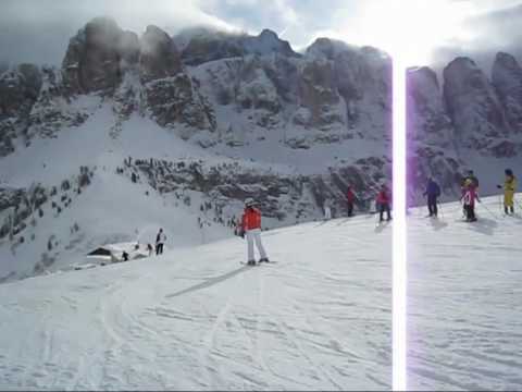
Starting point is Campitello in the Val di Fassa. With the funicular and a nice view to the mountain Plattkofel you arrive in the skiing area Col Rodella. At your first downhill there is a wonderful view to the Langkofel mountain and after using one ski lift you have a very long ski-run, passing the Sella Joch and down to Wolkenstein.
Via a walking bridge and some ski lifts you arrive at the Grödner Joch. From here a long ski-run ends in Colfosco and after a chair lift you arrive in Covara. Via a long funicular you arrive below the Piz Boe in 2000 m and from here fantastic ski-runs to Passo Campolongo and after a further chair lift to Araba.
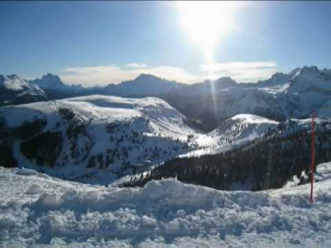
Two different funiculars guide to the Porta Vesco (the right one direct and the left one in two steps). From the top you have a wonderful view to the Sella-Group and to the glacier Marmolada. A long and in the beginning steep ski-run guides to the valley at Pont de Vauz and via ski lifts to Pordoi Joch and the skiing area Belvedere. From Belvedere you have a very nice view to the Sella Group and your starting point with the Langkofel mountain. Now we used the very long ski-run starting at 2395 m via the Belvedere and the valley ski-run down to Canazei in 1500 m. If you want closing the circle and not going to Canazei, than turn right to Pian Frataces and from there with a funicular back to starting area Col Rodella.
After a walk to the center of Canazei we used the ski-bus back to Campitello.
Have fun with this nice ski tour. The atached action videos shows:
Part 1 / 2: From Campitello via Wolkenstein to Araba
Part 2 / 2: From Araba via Belvedere to Canazei
Video 3: Sella-Ronda green and orange in one day
P.S. Video-clips to my gps-tours - based on different categories - you can find under the attached link in furtherinformation
Ulteriori informazioni sotto
http://hvdh.info/Galleria itinerari


Mappa itinerario e altimetria
Altezza minima 1419 m
Altezza massima 2527 m
Maggiori informazioni sull'autore del tour
|
|
HvdH |
Commenti

The start of this Sella-Ronda is in Campitello at the funicular with a large parking area .
From the areas around you can use the skiing busses to go to this place. You can start as well at any place close to the circuit.
Tracce GPS
Punti di traccia-
GPX / Garmin Map Source (gpx) download
-
TCX / Garmin Training Center® (tcx) download
-
CRS / Garmin Training Center® (crs) download
-
Google Earth (kml) download
-
G7ToWin (g7t) download
-
TTQV (trk) download
-
Overlay (ovl) download
-
Fugawi (txt) download
-
Kompass (DAV) Track (tk) download
-
Scheda tecnica (pdf) download
-
File originale dell'autore (gpx) download
Maggiori informazioni sull'autore del tour
|
|
HvdH |
Aggiungi ai miei preferiti
Rimuovi dai miei preferiti
Modifica dei tag
Tour aperto
Il mio voto
Vota