
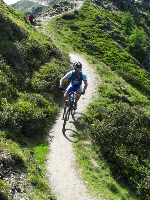

Tour starts with long uphill on unpaved road. You can park your car on parking at the bottom of cable car station. On the top there is nice cottage with good strudel and other cakes. Downhill is on the average not very difficult for bikers of all mountain category, but there are some short parts with S2 singletrail skala difficulty. About 1/3 of downhill is on the unpaved road, other part is trail. Somewhere in the middle of downhill you will probably think that track is wrong (small cottage on the left). Just proceed and follow the track. After short walk through bushes trail will continue. The bottom part of downhill is steep trail in the forest.Please take care not to leave traces of braking on the trail.
Ulteriori informazioni sotto
http://84.255.207.31/gallery/v/uporabniki/pokora/goldeck2/Galleria itinerari


Mappa itinerario e altimetria
Altezza minima 561 m
Altezza massima 2070 m
Maggiori informazioni sull'autore del tour
|
|
cindro |
Commenti

Tour starts in Spittal at cable car station.
Tracce GPS
Punti di traccia-
GPX / Garmin Map Source (gpx) download
-
TCX / Garmin Training Center® (tcx) download
-
CRS / Garmin Training Center® (crs) download
-
Google Earth (kml) download
-
G7ToWin (g7t) download
-
TTQV (trk) download
-
Overlay (ovl) download
-
Fugawi (txt) download
-
Kompass (DAV) Track (tk) download
-
Scheda tecnica (pdf) download
-
File originale dell'autore (gpx) download
Maggiori informazioni sull'autore del tour
|
|
cindro |
Aggiungi ai miei preferiti
Rimuovi dai miei preferiti
Modifica dei tag
Tour aperto
Il mio voto
Vota