
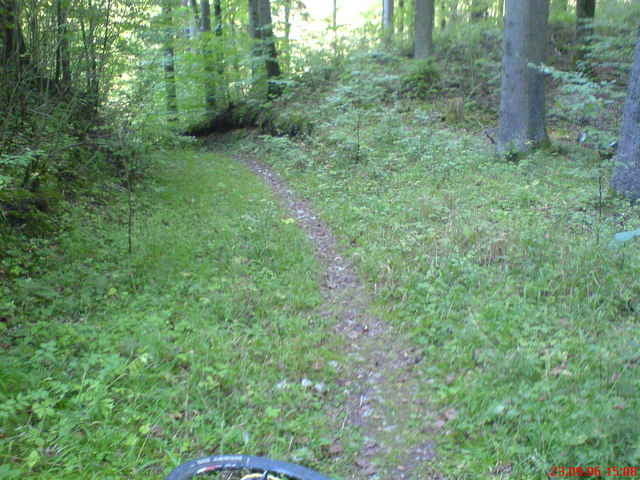

Short but very fun route. Lots of Singletrack. Very technical and fun with lots of short, steep climbs and crazy-fun downhills. A few short sections where you'll have to carry the bike.
The ride starts with a 1km dirt road section, then begins following the singletrack through the woods. You'll eventually end up at the Maximillian Grotto (1/2 way point). There are lots of cool cliffs, rock formations, and a lots of climbing options around here also (some bolted, some not).
All in all its an absolutely great route through some of the coolest rocks in the area. Only drawback is there are a few short sections along a rather busy road, but no big deal.
----------------------------------------------------
Kurz aber aufregende Trail. "Singletrack"!!!
Viele singletrack und Wurzeln. Etwas technisch und sehr Spaßvoll mit steilen rampen und anspruchvoll Downhill. Einige kurze schiebe passagen.
Schone Klippen und Aussichten.
Viel Spass,
Adam
Galleria itinerari

Mappa itinerario e altimetria
Altezza minima 448 m
Altezza massima 554 m
Maggiori informazioni sull'autore del tour
|
|
adamschlang |
Commenti

Parkplatz auf B85
Tracce GPS
Punti di traccia-
GPX / Garmin Map Source (gpx) download
-
TCX / Garmin Training Center® (tcx) download
-
CRS / Garmin Training Center® (crs) download
-
Google Earth (kml) download
-
G7ToWin (g7t) download
-
TTQV (trk) download
-
Overlay (ovl) download
-
Fugawi (txt) download
-
Kompass (DAV) Track (tk) download
-
Scheda tecnica (pdf) download
-
File originale dell'autore (gpx) download
Maggiori informazioni sull'autore del tour
|
|
adamschlang |
Aggiungi ai miei preferiti
Rimuovi dai miei preferiti
Modifica dei tag
Tour aperto
Il mio voto
Vota